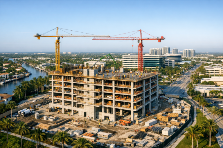
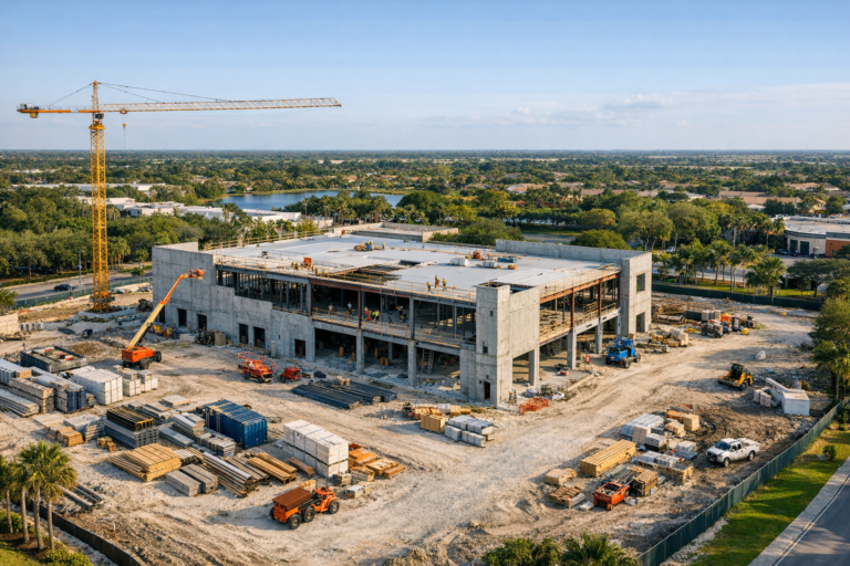
Construction progress is difficult to explain with words alone. A superintendent may describe completed slab work, staged materials, roof installation, site access, or utility progress in a written update, but many stakeholders still need visual context to understand what is actually happening on the ground. That is where aerial progress photography becomes especially valuable.
A well-planned drone photograph can show the status of an entire construction site in a single frame. Instead of relying on scattered ground photos, partial angles, or lengthy explanations, one carefully composed aerial image can communicate layout, movement, completed work, active work zones, surrounding conditions, and overall project momentum.
For developers, general contractors, construction managers, architects, engineers, property owners, and investors, that single image can become a practical documentation tool. It can support progress reports, owner updates, marketing presentations, payment applications, internal coordination, and long-term project records.
Why One Aerial Image Can Say More Than a Dozen Ground Photos
Ground-level photography is useful, but it has limitations. A photo taken from standing height usually shows one detail, one elevation, or one section of the project at a time. It may document a wall, an entrance, a staging area, or interior progress, but it rarely explains how the entire site is developing.
A drone image captures the project from above, showing relationships that are hard to see from the ground. It can reveal how a building footprint fits within the property, where crews are working, how materials are staged, whether access routes are clear, and how completed work compares with the planned sequence.
This wider perspective is especially helpful when project stakeholders are not on site every day. Owners, investors, lenders, design teams, and corporate decision-makers often need fast, accurate visual updates. A single high-quality aerial image gives them a clear snapshot without requiring them to interpret dozens of disconnected photos.
What Makes an Effective Construction Progress Drone Image?
Not every drone photo is useful for construction documentation. A beautiful image is not always an informative image. For progress tracking, the photograph must be intentionally planned so it captures the right angle, the right height, the right subject, and the right level of detail.
Consistent Point of View
Consistency is one of the most important elements of construction progress photography. When drone images are captured from similar positions over time, project teams can compare one update to the next with greater accuracy. Changes in structure, site grading, roofing, paving, landscaping, and surrounding improvements become easier to see.
A consistent point of view also makes progress updates more professional. When each image follows the same general composition, the project record is easier to review and more useful as a visual timeline.
Clear View of the Entire Site
An effective aerial progress image should show more than the building itself. It should include enough surrounding context to help viewers understand access points, material staging areas, parking areas, adjacent properties, drainage features, roadways, and other site conditions.
This is particularly important in South Florida, where commercial projects may be surrounded by active roads, neighboring buildings, water features, tight urban parcels, or operating businesses. The broader view helps project teams understand how construction activities fit within the larger environment.
Proper Altitude and Angle
The best image is not always taken from directly overhead. A straight-down view can be useful for layout, grading, and roof documentation, but an oblique angle often tells a better story in a single image. An angled perspective can show vertical progress, building height, facade work, roof conditions, surrounding roads, and on-site activity at the same time.
The right altitude depends on the size of the site, the level of detail needed, nearby obstacles, airspace conditions, and the intended use of the image. A professional drone operator chooses the angle and height based on documentation goals, not guesswork.
How Aerial Progress Photography Supports Construction Teams
Construction teams use drone photography for more than attractive visuals. When captured properly, aerial images become working documentation that helps teams communicate, review, and make decisions.
Progress Reporting
Weekly, biweekly, or monthly drone images can be included in owner reports and project updates. A single image can show the current phase of work, completed milestones, and visible progress since the last update. This is especially helpful for stakeholders who rely on reports rather than in-person site visits.
Coordination Between Teams
General contractors, subcontractors, architects, engineers, and owners often view a project from different perspectives. Aerial images provide a shared visual reference. When everyone can look at the same image, it becomes easier to discuss logistics, sequencing, access, and site constraints.
Documentation for Project Records
Construction projects move quickly, and site conditions can change from week to week. Aerial images create a visual record of how the project evolved. These records may be useful for internal review, future maintenance planning, dispute prevention, renovation planning, or historical documentation after completion.
Marketing and Stakeholder Communication
For developers and commercial real estate professionals, construction progress images can also support marketing and leasing communication. A polished aerial image can show momentum without needing a completed building. It can help future tenants, investors, and community stakeholders understand the scale and progress of the development.
What a Single Drone Image Can Reveal
A strong construction progress image can communicate several important details at once. Depending on the phase of the project, it may show:
- Site clearing, grading, and earthwork progress
- Foundation layout and slab placement
- Structural framing, tilt-wall panels, or vertical construction
- Roof installation and building envelope progress
- Material storage and staging areas
- Equipment locations and site logistics
- Parking lot, roadway, and access improvements
- Stormwater, drainage, and landscape progress
- Relationship to neighboring properties and roadways
The value is not just in seeing these elements. The value is seeing them together. Construction decisions often depend on relationships between different parts of the site, and aerial photography makes those relationships easier to understand.
Planning a Drone Progress Photo Shoot
To get the most value from aerial progress photography, the shoot should be planned around the project team’s documentation goals. A professional drone provider should ask what the images will be used for, who will review them, how often updates are needed, and whether a consistent vantage point is required.
Choose the Right Schedule
Some projects benefit from monthly documentation, while faster-moving or high-visibility projects may need weekly or biweekly updates. The right schedule depends on project duration, reporting requirements, stakeholder involvement, and the pace of visible change.
Recurring flights are especially useful because they create a reliable visual timeline. When images are captured on a consistent schedule, teams can better track progress and compare phases.
Consider Lighting and Weather
In South Florida, lighting and weather can change quickly. Harsh midday sun may create strong shadows, while afternoon storms can affect visibility and flight conditions. Early morning or late afternoon often provides cleaner light, depending on the site orientation and surrounding structures.
Professional planning also accounts for wind, rain, controlled airspace, nearby airports, temporary flight restrictions, and site safety conditions. Construction documentation should never come at the expense of safe drone operations.
Coordinate With Site Personnel
Drone flights on active construction sites should be coordinated with the appropriate site contact. The drone pilot needs to understand where people are working, where equipment is operating, and whether there are temporary hazards such as cranes, lifts, power lines, or restricted areas.
Clear communication helps the flight run efficiently and safely while minimizing disruption to construction activity.
Why Professional Drone Operation Matters
Hiring a professional drone company for construction progress photography is not just about image quality. It is also about safety, compliance, reliability, and understanding how to capture images that serve a business purpose.
Commercial drone operations in the United States must be conducted by a pilot operating under FAA Part 107 requirements. A professional provider should understand airspace authorization, operational limits, weather considerations, site hazards, and safe flight practices around people, equipment, structures, and vehicles.
Experience also matters in the final image. Construction sites are visually complex. A trained commercial drone operator knows how to frame the site clearly, avoid distracting angles, maintain consistent viewpoints, and capture images that are useful to decision-makers rather than simply dramatic.
Common Mistakes That Reduce the Value of Progress Photos
Many construction drone photos fail because they are captured without a documentation strategy. Common problems include inconsistent angles, flying too high to show meaningful detail, focusing only on aesthetics, missing important work areas, poor lighting, and failing to include surrounding context.
Another mistake is waiting too long between updates. If major phases are missed, the visual history becomes incomplete. For projects where documentation matters, it is better to establish a schedule early and maintain it through key milestones.
Finally, some teams rely only on casual drone images captured by someone on site. While these may be convenient, they may not meet the same standards for consistency, safety, image quality, or commercial use. Professional documentation provides a more reliable record.
FAQ
How often should construction progress drone photos be taken?
The right frequency depends on the project. Monthly flights may be enough for longer projects with gradual visible change, while weekly or biweekly flights are better for fast-moving projects, high-profile developments, or teams that need frequent stakeholder updates.
Can one drone image replace a full progress report?
No. A drone image should support a progress report, not replace it. However, one well-composed aerial image can make a report much easier to understand by giving readers immediate visual context.
What is the best angle for construction progress photography?
There is no single best angle for every project. Oblique aerial images are often ideal for showing both vertical progress and site context, while top-down images are useful for layout, roof work, grading, and site planning. Many projects benefit from both.
Is aerial progress photography useful before vertical construction begins?
Yes. Early-phase drone images can document clearing, grading, utilities, drainage, foundation work, access routes, and material staging. These early images are often valuable because they show conditions that may later be covered or changed.
Do drone flights disrupt construction activity?
When properly planned, drone flights are typically efficient and minimally disruptive. Coordination with the site contact helps ensure the pilot understands active work areas, safety requirements, and any temporary restrictions on the site.
A Clearer Way to Document Construction Progress
A single aerial image can do what many construction updates struggle to do: make progress immediately clear. It can show the full site, highlight visible milestones, provide context for decisions, and create a professional record that stakeholders can understand at a glance.
For construction teams, developers, and commercial real estate professionals, aerial progress photography is more than a visual upgrade. It is a practical communication tool that improves reporting, supports coordination, and documents the project from a perspective that ground photos cannot match.
Skyview Motions provides professional commercial drone photography and videography for construction and commercial real estate projects throughout South Florida. For teams that need clear, consistent, and reliable aerial documentation, our FAA Part 107 certified drone services help capture progress with accuracy, professionalism, and purpose.