Why Davie Construction Companies Use Drone Photography
Construction projects in Davie move through many visible stages: clearing, grading, foundations, framing, roofing, exterior work, paving, landscaping, and final closeout. Each phase has details that matter to owners, general contractors, subcontractors, architects, engineers, lenders, and property managers. Traditional ground photography can document parts of the job site, but it often misses the full picture.
That is why many local contractors now rely on construction drone photography Davie project teams can use for progress documentation, coordination, reporting, and marketing. A professional aerial view does more than look impressive. It helps teams understand site conditions, verify progress, identify constraints, and communicate clearly with people who may not visit the project in person.
For construction companies working in Davie and throughout Broward County, drone photography has become a practical documentation tool. When performed by an FAA-compliant drone operator with construction awareness, it can support better decision-making from preconstruction through project completion.
The Value of Seeing the Entire Job Site at Once
Most construction challenges involve relationships between multiple parts of a site. Where materials are staged affects access. Equipment placement affects traffic flow. Drainage work affects grading. Parking, neighboring properties, temporary fencing, laydown areas, and delivery routes all influence daily operations.
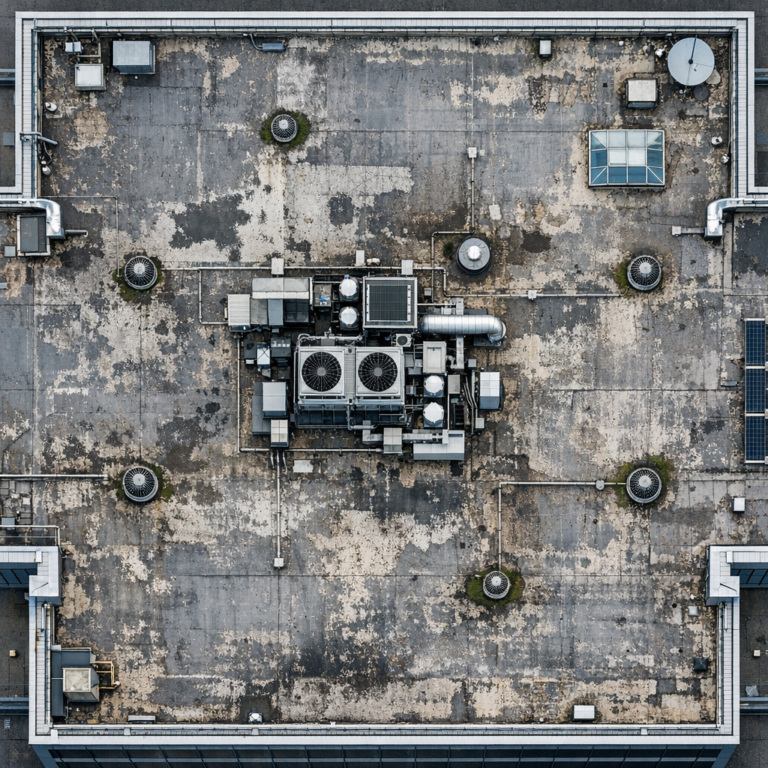
Ground-level photos are useful, but they are limited by line of sight. Aerial photography provides a broader perspective. From above, construction managers can see how different activities interact across the project footprint.
Better Context for Progress Reviews
Progress meetings often involve people looking at schedules, drawings, reports, and photos. Drone photography adds visual context to those conversations. Instead of describing where work stands, teams can point to a current image and discuss what is visible.
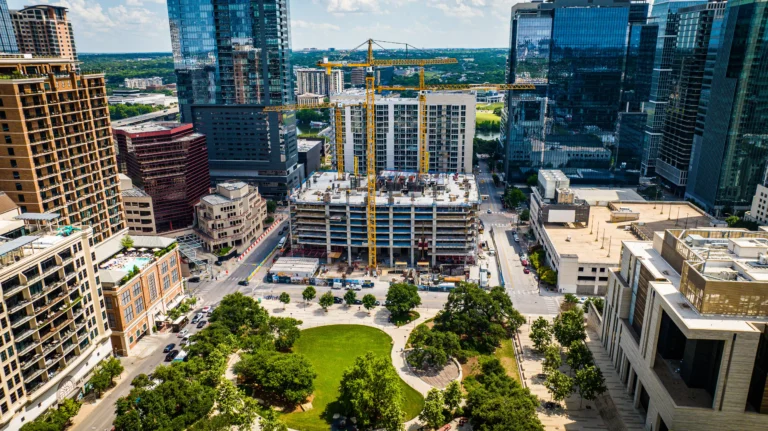
For example, on a commercial building project, aerial images can show foundation progress, completed utility trenches, delivery areas, roof installation, and surrounding site work in one frame. This helps owners and consultants understand the project status without relying only on written updates.
More Complete Documentation Than Ground Photos Alone
Ground photos are still important for close-up details, but they do not always show relationships across the site. Drone photography fills that gap by capturing site-wide conditions. When used together, ground and aerial photography create a stronger construction record.
This is especially valuable on larger sites, multi-building developments, retail centers, industrial properties, schools, municipal work, and commercial renovations with active access constraints.
How Drone Photography Supports Construction Progress Documentation
Construction progress photography is most useful when it is consistent. Random photos are better than nothing, but scheduled documentation creates a visual timeline. Weekly, biweekly, or milestone-based drone flights allow teams to compare progress over time.
A consistent aerial record can help document what was completed, when site changes occurred, and how the project developed from start to finish. This supports communication, internal records, and project closeout documentation.
Tracking Visible Milestones
Drone photography can document major visible milestones such as:
- Site clearing and earthwork
- Stormwater and utility installation
- Foundation and slab placement
- Structural framing and vertical construction
- Roofing and exterior envelope work
- Parking areas, sidewalks, and hardscape installation
- Landscaping and final site conditions
These images help contractors show measurable progress without overcomplicating the report. They also help remote stakeholders quickly understand where the project stands.
Creating a Reliable Visual Timeline
When aerial photos are captured from similar angles at regular intervals, they become more than individual images. They become a timeline. Teams can compare week-to-week changes, identify work sequences, and review how decisions affected site development.
For owners and developers, this record is useful long after the project is complete. It can support portfolio documentation, internal presentations, investor updates, and property management references.
Why Davie Projects Benefit From Aerial Documentation
Davie has a varied construction environment. Projects may be near commercial corridors, educational facilities, equestrian areas, residential communities, wetlands, canals, or busy roadways. These site conditions make visual coordination important.
Aerial photography can help project teams understand how the construction area connects with surrounding properties, access points, drainage features, staging zones, and traffic patterns. This is particularly useful when working in developed areas where space is limited.
Site Logistics and Access Planning
Drone photos can show whether materials are organized efficiently, whether access points remain clear, and how temporary site conditions are affecting circulation. A superintendent may already understand these details from daily observation, but aerial images make them easier to communicate to others.
For example, a project team reviewing an aerial image may notice that a laydown area is starting to interfere with a planned delivery route. Addressing that issue early can help reduce friction between trades and keep daily operations moving more smoothly.
Communication With Stakeholders Who Are Not On Site
Not every decision-maker can visit a Davie job site regularly. Owners, developers, architects, engineers, lenders, and corporate teams may be located elsewhere. Clear drone photography gives them an accurate current view without requiring additional site visits.
This can reduce confusion and make project updates more efficient. It can also help construction managers answer questions with visual evidence rather than lengthy explanations.
Practical Uses for Construction Drone Photography
Professional drone photography can serve several purposes during a construction project. The most effective use depends on the project type, phase, and audience.
Owner and Developer Updates
Owners want to see progress clearly. Aerial photography turns a written update into a visual report. It can show the status of site work, building progress, parking areas, and overall project movement in a way that is easy to understand.
Internal Project Coordination
General contractors and construction managers can use drone images during coordination meetings. Aerial photos can help teams discuss staging, site access, safety zones, completed work areas, and upcoming phases.
Architect and Engineer Reference
Design professionals may benefit from current aerial context when reviewing field conditions, site relationships, or visible progress. Drone photos do not replace inspections, surveys, or official documentation, but they can provide helpful visual reference.
Marketing and Portfolio Content
Construction companies also use aerial images to document their capabilities. Completed project photos are valuable, but progress images can be equally useful. They show process, scale, and construction expertise. For websites, proposals, capability statements, and social media, professional construction imagery can help communicate credibility.
What Makes Professional Drone Photography Different
Not all drone photography is suitable for construction documentation. A professional approach requires more than simply flying over a site and taking pictures. It requires planning, safety awareness, FAA compliance, and an understanding of what construction teams actually need to see.
Consistent Angles and Repeatable Documentation
For progress tracking, consistency matters. Professional drone operators can capture similar viewpoints over time so each set of images is easier to compare. This makes the final photo library more useful and organized.
FAA-Compliant Operations
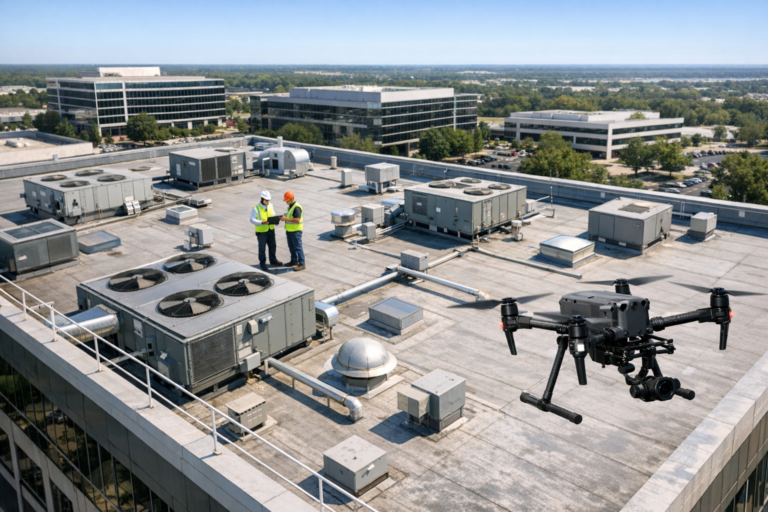
Commercial drone work must be handled in accordance with FAA requirements. This is especially important near controlled airspace, populated areas, roads, and active job sites. Construction companies should work with properly qualified operators who understand safe operating procedures and airspace limitations.
Construction-Aware Image Capture
A construction-focused drone photographer knows to capture more than attractive aerial views. Useful photo sets may include overall site views, access points, staging areas, roof progress, vertical construction, adjacent roads, drainage areas, and key work zones. The goal is to produce images that help the project team, not just images that look good.
Best Practices for Getting Better Drone Progress Photos
Construction companies can get more value from drone photography by planning ahead. The following practices help create a stronger visual record.
- Set a schedule. Weekly, biweekly, or milestone-based flights create consistency.
- Identify key viewpoints. Choose angles that show the full site, main structure, access points, and active work areas.
- Coordinate with the site team. Make sure the operator understands site access, safety expectations, and restricted areas.
- Capture both wide and focused views. Wide shots show context, while closer aerial views highlight specific progress.
- Organize images by date. Proper file organization makes the photo record easier to use later.
- Plan for final completion photos. The finished project should be documented when site conditions are clean and visually complete.
For companies that want a dependable documentation process, Skyview Motions provides professional construction drone photography for commercial projects with a focus on clarity, consistency, and FAA-compliant operations.
Common Mistakes to Avoid
Drone photography is most effective when it is structured. Construction teams should avoid treating it as a last-minute add-on. Waiting until the end of a project means missing the most useful documentation phases.
Another common mistake is capturing photos from random angles each time. While those images may still be visually appealing, they are harder to compare. Repeatable viewpoints create a clearer timeline.
It is also important to avoid relying on aerial photos for purposes they are not designed to serve. Drone photography can support documentation and communication, but it does not replace licensed surveying, inspections, engineering review, or official compliance records.
FAQ About Construction Drone Photography in Davie
How often should a construction site be photographed by drone?
The best schedule depends on the project. Weekly flights are helpful for fast-moving construction. Biweekly or monthly flights may be enough for slower phases. Some teams schedule flights around major milestones such as foundation work, framing, roofing, and final completion.
Can drone photography help with construction disputes?
Aerial photos can provide useful visual documentation of site conditions and progress over time. While they are not a substitute for contracts, inspections, or expert analysis, organized progress photos can help clarify what was visible at specific points in the project.
Is drone photography safe on an active construction site?
It can be when performed by a qualified commercial drone operator following FAA rules and site-specific safety procedures. Coordination with the construction team is important so flights do not interfere with workers, equipment, deliveries, or restricted areas.
What types of Davie construction projects benefit most?
Commercial buildings, retail centers, industrial sites, multifamily developments, schools, municipal projects, road-adjacent work, and large renovation projects can all benefit. Any project with multiple stakeholders or complex site logistics may gain value from aerial documentation.
Can drone photos be used for marketing after the project is finished?
Yes. High-quality aerial progress and completion photos can be used for websites, proposals, portfolio pages, presentations, and social media, provided the construction company has the appropriate permissions from the property owner or project stakeholder.
Conclusion
Construction companies in Davie use drone photography because it solves real communication and documentation challenges. It gives project teams a clear view of site progress, logistics, access, staging, and major milestones. It also helps owners, developers, architects, and other stakeholders understand the project without needing to be on site every week.
The best results come from a professional, consistent, FAA-compliant approach. When aerial images are captured at the right intervals and from useful viewpoints, they become a reliable visual record from early site work through final completion.
For contractors, developers, and construction managers looking to improve project documentation, construction drone photography in Davie is a practical investment in clarity. Skyview Motions helps project teams capture professional aerial imagery that supports communication, documentation, and long-term project value.