Construction projects move quickly, and the details that matter are not always visible from the ground. Crews may be working across multiple elevations, materials may be staged in several areas, and site conditions can change from one week to the next. For project teams in Broward County, drone photography provides a practical way to see the full picture with clarity.
Professional aerial documentation is no longer just a marketing asset. It has become a valuable project communication tool for developers, general contractors, owners, architects, engineers, and stakeholders who need accurate visual updates without being physically present on site. When captured consistently and professionally, drone imagery helps teams understand progress, verify conditions, document milestones, and communicate with greater confidence.
For teams comparing construction drone services Broward County providers, the most important question is not simply who can fly a drone. The better question is who can safely, legally, and consistently capture useful construction documentation that supports real project decisions.
Why Drone Photography Matters on Broward County Construction Sites
Broward County construction projects often operate in dense, active environments. Sites may be near roadways, waterways, businesses, airports, residential areas, or existing commercial properties. Ground photography still has value, but it cannot always show how each part of the project relates to the whole.
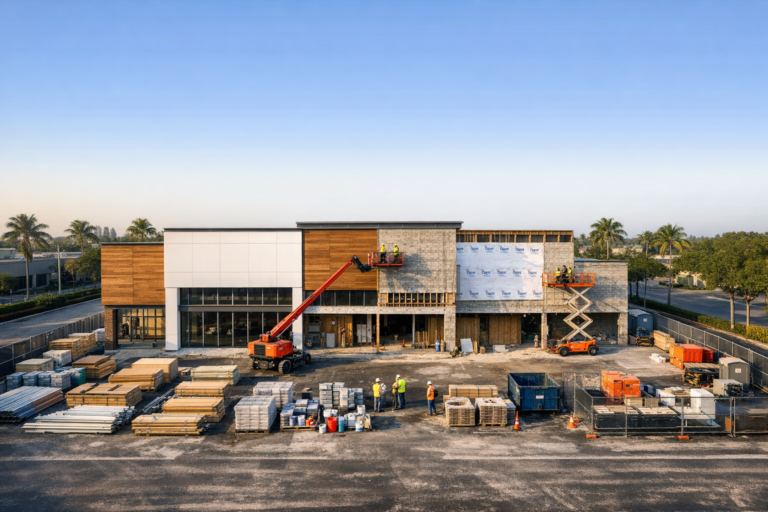
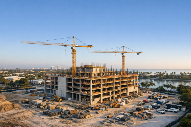
Drone photography fills that gap by capturing context. Aerial images can show site access, staging areas, building orientation, parking areas, roofing progress, exterior work, surrounding infrastructure, drainage patterns, and overall site organization. This perspective helps teams quickly understand what has changed and what may need attention.
For owners and decision-makers who are not on site every day, a well-planned aerial photo set can replace long explanations with clear visual evidence. Instead of relying only on written updates, project teams can see visible progress and compare it against schedules, milestones, and previous documentation.
What Project Teams Gain from Professional Drone Documentation
The value of construction drone photography comes from consistency, clarity, and perspective. A single aerial image may be useful, but recurring drone documentation over the life of a project creates a visual record that becomes more valuable over time.
Clearer Progress Tracking
Progress can be difficult to communicate when multiple trades are working simultaneously. Drone photography helps show what has been completed, what is in progress, and where changes have occurred. For example, a phased commercial buildout may include grading, utility work, vertical construction, roofing, exterior finishes, paving, and landscaping. Aerial documentation helps create a chronological record of each stage.
This is especially useful when project teams need to compare current site conditions with prior weeks or months. Consistent angles and repeatable flight paths can make progress easier to review and reduce confusion during status meetings.
Better Stakeholder Communication
Owners, investors, executives, lenders, and off-site stakeholders often need updates but may not have the time or ability to visit the property. Drone photos and videos provide a professional, visual summary of site activity that is easier to understand than technical language alone.
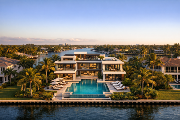
Aerial visuals can also help marketing teams and developers communicate momentum. Without overstating progress, professional imagery can show that a project is active, organized, and advancing. This can be valuable for leasing, sales, investor communications, internal reporting, and public-facing updates.
More Complete Site Awareness
Drone imagery can reveal relationships that are hard to evaluate from ground level. Teams can see how equipment is positioned, where deliveries are staged, whether access routes are clear, how exterior areas are developing, and how the project fits within surrounding properties.
This broader perspective does not replace site walks, survey work, inspections, or engineering review. Instead, it supports them by giving teams an additional visual layer for discussion and documentation.
Stronger Records for Milestones
Construction projects involve many milestones: clearing, grading, foundation work, structural progress, dry-in, exterior completion, paving, landscaping, and final delivery. Drone photography can document these moments from a perspective that shows both detail and context.
When organized properly, these image sets create a useful project archive. If questions arise later about timing, visible site conditions, or completed exterior work, aerial documentation can help teams review what was captured at a specific point in the schedule.
Construction Drone Photography Versus Videography
Both photography and videography have a place in construction documentation, but they serve different purposes.
Drone photography is often best for detailed review, reporting, comparisons, and records. Still images are easy to share in presentations, progress reports, construction updates, real estate packages, and internal documentation. They allow viewers to pause, zoom, and study specific areas.
Drone videography is better for showing movement, scale, sequence, and overall project atmosphere. Video can be useful for executive updates, marketing, leasing presentations, social media, and milestone recaps. A short edited video can communicate the size and energy of a project more effectively than still images alone.
Many construction teams benefit from using both. A typical monthly documentation package may include a curated set of high-resolution aerial photos along with a short progress video. The photos support detailed review, while the video provides a concise project overview.
What a Professional Construction Drone Shoot Should Include
A construction drone shoot should be planned around the project goals, not just the flight itself. Before the drone is ever in the air, a professional operator should understand what the team needs to document and how the visuals will be used.
Pre-Flight Planning
Good planning includes reviewing the site location, nearby airspace considerations, access points, potential obstacles, sun position, active work areas, and preferred deliverables. In South Florida, weather is also an important factor. Wind, rain, heat, cloud cover, and changing light can all affect the timing and quality of aerial imagery.
For Broward County projects, planning may also include evaluating proximity to airports, heliports, busy roads, populated areas, and controlled airspace. Commercial drone operations should be performed by an FAA Part 107 certified remote pilot who understands how to operate within applicable rules and site-specific conditions.
Consistent Angles and Repeatable Coverage
For progress documentation, consistency matters. Capturing the same general angles during each visit makes it easier to compare changes over time. These may include overhead site views, oblique views of each building elevation, access roads, parking areas, staging zones, and surrounding context.
The goal is not to capture as many random images as possible. The goal is to capture the right images in a way that supports project review.
Professional Editing and Organization
Raw aerial images are not always ready for client use. Professional editing helps ensure the photos are clear, properly exposed, level, and consistent. Deliverables should also be organized so the project team can quickly locate and share what they need.
Depending on the project, file organization may include date-based folders, selected hero images, full-resolution files, web-friendly versions, or separate categories for each phase or building area.
How Often Should Construction Sites Be Photographed by Drone?
The right schedule depends on the project timeline, reporting needs, and pace of work. Weekly documentation may be appropriate for fast-moving sites, major milestone periods, or projects with frequent stakeholder reporting. Biweekly or monthly drone photography may be enough for longer-duration projects where visible changes happen more gradually.
Some teams schedule drone coverage around specific milestones rather than recurring dates. This can work well for key phases such as site clearing, foundation completion, structural topping out, roof installation, exterior completion, or final project delivery.
The best approach is usually to match the flight schedule to the decisions the images need to support. If project leaders are reviewing progress every month, monthly documentation may be sufficient. If off-site stakeholders need frequent updates, a more regular schedule may be worthwhile.
Safety, Compliance, and Professional Standards Matter
Construction sites are active environments with people, equipment, cranes, materials, temporary structures, and changing conditions. Drone operations should never add unnecessary risk to the site.
A professional drone provider should prioritize safety planning, maintain visual awareness, avoid interfering with site activity, and coordinate with the appropriate project contact when needed. The pilot should also understand FAA Part 107 requirements for commercial drone operations, including airspace considerations, operating limitations, and safe flight practices.
Insurance, professionalism, communication, and reliability also matter. Project teams are trusting a drone provider to operate around valuable property, active crews, and schedule-sensitive work. The lowest-cost option is not always the best fit when the documentation will be used for reporting, owner updates, or public-facing marketing.
How to Choose a Construction Drone Provider in Broward County
When evaluating a provider, look beyond portfolio images. Strong construction drone documentation requires both technical flight skill and an understanding of what project teams actually need.
Ask whether the provider is FAA Part 107 certified, experienced with commercial and construction environments, able to capture repeatable progress imagery, and capable of delivering files in a professional format. It is also worth discussing turnaround times, scheduling flexibility, weather policies, and how the provider plans flights around site activity.
A good drone partner should ask questions before quoting or scheduling. They should want to understand the property, the phase of construction, the audience for the imagery, preferred angles, required deliverables, and any safety or access considerations. That conversation is often a good indicator of whether the provider is focused on useful documentation or simply taking aerial photos.
Practical Ways Project Teams Use Drone Images
Construction drone photography can support several departments and decision-makers at the same time. A general contractor may use aerial images for progress meetings. A developer may use them for investor updates. A real estate team may use them for leasing materials. An architect or engineer may use them to review visible exterior progress and site context.
Common uses include monthly progress reports, owner presentations, lender updates, public relations, website updates, social media, pre-completion marketing, project archives, and final case study visuals. The same image set can often serve multiple purposes when it is captured with care.
For example, an overhead view may help the project team review site layout, while an angled exterior shot may be better for marketing. A professional drone provider should understand both needs and capture imagery that supports operational review as well as polished communication.
FAQ
Do construction drone services replace traditional site photography?
No. Drone photography complements ground photography. Ground photos are better for close-up details, interior work, and trade-specific documentation. Drone photos are better for showing overall progress, site layout, building context, access, and large exterior areas.
Is a license required for commercial construction drone photography?
Yes. In the United States, commercial drone operations generally require an FAA Part 107 certified remote pilot. Construction documentation for a business purpose is considered commercial use.
How long does a construction drone shoot take?
The time depends on site size, shot list, airspace, weather, and deliverables. A focused progress photo flight may be completed relatively quickly, while larger sites or combined photo and video shoots require more planning and flight time.
Can drone photography be captured while crews are working?
Often, yes, but it must be done safely and with proper coordination. The pilot should avoid disrupting work, maintain safe operations, and follow applicable FAA rules and site requirements.
What deliverables should a project team request?
Most teams benefit from high-resolution edited images, organized folders by date, web-friendly versions for sharing, and optional edited video clips when marketing or executive updates are needed. For recurring progress, consistent viewpoints are especially valuable.
Final Thoughts
Construction drone photography gives Broward County project teams a clearer, more complete view of their work. It supports progress tracking, improves communication, strengthens documentation, and helps stakeholders understand what is happening on site without relying on guesswork.
The best results come from working with a professional drone provider that understands construction environments, safety expectations, FAA requirements, and the practical needs of project teams. When aerial documentation is planned and captured correctly, it becomes more than attractive imagery. It becomes a reliable project communication tool.
Skyview Motions provides professional commercial drone photography and videography for construction projects throughout South Florida. For Broward County developers, contractors, property teams, and project stakeholders, our goal is to deliver clear, useful aerial documentation that helps your team communicate progress with confidence.