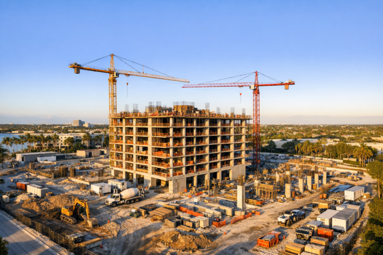
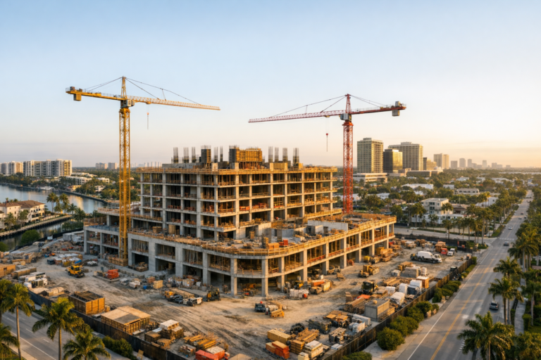
Commercial development moves quickly, but the people who need updates are rarely standing on the jobsite every week. Investors, ownership groups, lenders, tenants, architects, brokers, and municipal stakeholders often depend on progress reports to understand what is happening and whether the project is moving according to plan.
That is why more developers are adding professional drone photography to their project update process. Aerial imagery provides context that ground-level photos cannot: the full site layout, surrounding access points, vertical progress, staging areas, completed phases, and the relationship between the project and its environment.
For commercial developments in South Florida, where projects may involve tight urban sites, coastal properties, active roadways, phased construction, and multiple decision-makers, drone photography can make project communication clearer, faster, and more useful. When planned properly, commercial construction drone services become more than marketing visuals. They become a practical documentation tool.
Why Traditional Project Photos Often Fall Short
Ground photography is still important. It captures interior work, close-up details, field conditions, finishes, and specific construction activities. But ground photos alone can leave decision-makers with an incomplete picture.
A typical project update may include dozens of images, yet still fail to answer basic questions. How much of the roof is complete? Where are materials being staged? What areas are active this week? How does the new building sit on the parcel? Is the parking field taking shape? Are sitework and vertical construction progressing together?
Drone photography helps connect those pieces. It provides a top-down and angled perspective that shows the project as a whole. Instead of reviewing fragmented images, stakeholders can see the site in context and understand progress at a glance.
What Developers Gain From Drone-Based Project Updates
The strongest benefit of drone photography is clarity. Aerial images simplify complex construction activity into visuals that are easy to interpret, even for people who are not involved in daily field operations.
Clearer Communication With Stakeholders
Commercial projects often involve people with different priorities. A developer may care about schedule and overall progress. A lender may want evidence that work is advancing. A broker may need updated visuals for leasing conversations. Ownership may want confidence that the project is moving forward.
Drone photography gives everyone a shared visual reference. Rather than relying only on written updates or isolated site photos, teams can review aerial images that show the current state of the project. This reduces confusion and makes status conversations more productive.
Better Documentation of Milestones
Many project milestones are easier to understand from the air. Site clearing, grading, foundation work, structural progress, roof installation, exterior envelope work, paving, landscaping, and substantial completion all photograph well from an aerial perspective.
Consistent drone captures create a visual timeline of the project. Over time, those images can help document what changed, when certain phases became visible, and how the development evolved from land to completed asset.
More Useful Updates for Remote Decision-Makers
Not every investor, owner, or executive can visit the jobsite regularly. This is especially true in South Florida, where commercial projects may be funded or managed by groups located outside the region.
Aerial progress photography allows remote decision-makers to see meaningful site conditions without requiring a visit. It does not replace formal reporting, inspections, or project management tools, but it strengthens them by adding visual proof that is easy to understand.
How Drone Photography Supports Construction Progress Reporting
Construction progress reporting is most effective when it is consistent. One set of drone images is helpful, but recurring aerial documentation is far more valuable.
When imagery is captured from similar angles and altitudes over time, teams can compare progress more easily. A monthly or biweekly drone shoot can show how the building footprint, sitework, roofline, parking areas, utility zones, and exterior improvements are changing.
For example, a developer might use aerial images to show that tilt-wall panels are erected, the roof is drying in, site paving has begun, and landscape areas are being prepared. These updates can be included in ownership reports, lender packages, internal presentations, sales materials, or tenant communications.
The key is planning. A professional drone provider should understand what the images are intended to communicate. A project update for investors may require different angles than marketing images for leasing or close documentation of a construction milestone.
Why Aerial Context Matters in Commercial Development
Commercial real estate is highly location-driven. A building is not evaluated only by what is inside its walls. Access, visibility, surrounding roads, neighboring properties, parking, water proximity, traffic patterns, and nearby amenities all affect how a development is perceived.
Drone photography can show that context in a way ground photos cannot. For a retail center, aerial images can show road frontage, parking layout, tenant pads, and proximity to surrounding neighborhoods. For an industrial facility, drone images can show loading areas, truck access, outdoor storage, and site circulation. For a multifamily or mixed-use project, aerials can show the building relationship to nearby districts, transit corridors, beaches, waterways, or downtown areas.
This context is especially valuable in South Florida, where commercial sites often compete based on visibility, accessibility, and proximity to major corridors or coastal destinations.
Drone Photography as a Marketing Asset
Although project updates are often created for internal communication, the same aerial content can support marketing when captured professionally.
Developers may use polished drone photography for pre-leasing campaigns, investor presentations, project announcements, website updates, social media, press materials, and sales decks. As the project nears completion, aerial visuals can help present the property at its strongest.
The difference between basic documentation and marketing-ready imagery is execution. Commercial marketing images require attention to light, composition, weather, site cleanliness, angle selection, and final image quality. A midday utility shot may document progress, but it may not be the best image to represent a high-value development publicly.
A skilled drone team can capture both practical documentation and polished commercial visuals during the same visit when properly planned.
What to Look for in Commercial Construction Drone Services
Not all drone photography is equal, especially on active or near-active construction sites. Developers should evaluate more than camera quality before hiring a provider.
FAA Part 107 Certification
Commercial drone operations in the United States require a remote pilot certificate under FAA Part 107. Developers should work with a properly certified drone pilot who understands airspace considerations, operational limits, flight planning, and safe commercial procedures.
Experience Around Commercial Sites
Construction environments require awareness. Equipment, cranes, workers, temporary structures, vehicles, utilities, and changing site conditions all affect planning. A professional drone operator should communicate clearly, avoid disrupting work, and maintain safe operating practices.
Consistent Capture Planning
For progress updates, consistency matters. Ask whether the provider can capture repeatable views, maintain organized file delivery, and document the site from angles that support your reporting needs.
Professional Image Quality
Images should be sharp, well-composed, properly exposed, and delivered in a format suitable for the intended use. A developer may need web-ready files for updates and higher-resolution images for presentations or marketing materials.
Understanding of Business Goals
The best results come from a provider who asks why the images are being captured. Investor reporting, construction documentation, leasing, public relations, and owner updates each require a slightly different visual approach.
How Often Should Developers Schedule Drone Updates?
The right schedule depends on project size, pace, reporting requirements, and budget. Many commercial projects benefit from monthly aerial updates. Faster-moving projects, high-visibility developments, or jobs with frequent stakeholder reporting may benefit from biweekly capture.
Drone photography is especially valuable at major milestones, including pre-construction site conditions, clearing and grading, foundation progress, structural work, roofing, exterior completion, paving, landscaping, and final completion.
For long-term developments, establishing a capture schedule early helps create a more complete project timeline. It also avoids the common problem of realizing too late that important phases were never photographed from the air.
Practical Ways to Use Drone Images in Project Updates
Developers can get more value from aerial imagery by using it intentionally. Instead of simply adding photos to a folder, incorporate them into communication workflows.
Use aerial images at the beginning of monthly reports to orient the reader. Pair them with a brief summary of what changed since the last update. Include annotated versions internally when helpful, while keeping clean versions for marketing. Compare current images with previous captures to show visible progress over time. Save milestone images in an organized archive so they can be used later for case studies, closeout presentations, or portfolio materials.
Drone images can also support meetings. A recent aerial view gives teams a common reference point when discussing access, phasing, logistics, tenant areas, parking, or exterior improvements.
Common Mistakes to Avoid
One mistake is waiting until the project is nearly complete. Final aerial images are useful, but they do not tell the full story of development. Early and mid-project imagery often provides the most valuable documentation.
Another mistake is treating drone photography as a one-time marketing task rather than a recurring project communication tool. Inconsistent angles, irregular timing, and scattered file organization can reduce the value of the imagery.
Developers should also avoid hiring based on price alone. Commercial construction drone services require safe operation, planning, reliability, quality control, and an understanding of how the images will be used. Poorly planned imagery can create more work for the project team instead of making communication easier.
FAQ
Is drone photography useful for every commercial construction project?
Most commercial projects can benefit from aerial documentation, but the value is highest when the site scale, stakeholder group, reporting needs, or marketing goals justify regular visual updates.
Can drone photography replace site visits or inspections?
No. Drone photography supports communication and documentation, but it does not replace professional inspections, site walks, engineering review, or contractor reporting responsibilities.
How far in advance should a drone shoot be scheduled?
Scheduling in advance is recommended, especially for construction sites with access requirements, safety protocols, or specific milestone timing. Weather and airspace considerations may also affect planning.
What should developers provide before a drone project?
Helpful information includes the site address, preferred capture goals, schedule constraints, access instructions, key viewpoints, intended use of the images, and any site-specific safety requirements.
Can drone images be used for both documentation and marketing?
Yes. With proper planning, a drone photography session can capture practical progress views as well as polished images suitable for presentations, websites, leasing materials, and public updates.
Conclusion
Drone photography has become a valuable addition to commercial project updates because it makes progress easier to see, understand, and communicate. For developers managing complex timelines and diverse stakeholder expectations, aerial imagery brings clarity to the reporting process.
Used consistently, drone photography can document milestones, strengthen investor and owner updates, support marketing, and create a visual archive of the full development process. The best results come from working with an FAA Part 107 certified provider that understands commercial construction environments and the business purpose behind each image.
Skyview Motions provides professional commercial construction drone services for developers, contractors, property teams, and real estate professionals throughout South Florida. If your project updates need clearer visuals and more useful documentation, our team can help plan and capture aerial imagery that supports your goals from groundbreaking through completion.