The Best Drone Photography Company
While the controversy over the use of drones for military and intelligence purposes rages on, some far less controversial uses of unmanned aerial systems (UAS) or unmanned aircraft vehicles (UAV) have surfaced in the real estate industry. The new regulations become operative on August 29, 2016, making it easier than ever to utilize a drone to film or take images of your listings. The NAR even participated in the new guidelines’ drafting, sensing the opportunity this presents in real estate marketing.
Roughly 20% of realtors who do not already utilize drones stated they plan to in the future, according to a recent NAR member study. This development is likely being influenced by the younger generation of realtors entering the industry. They are also more likely to be tech-savvy individuals.
Although 56% of realtors say they don’t use drones currently, 18% say they want to shortly. This will tip the odds in favor of the growing number of realtors who take property photos with drones.
FAA Part 107 certified, Virtuals 1 photographers operate unmanned aerial vehicles (UAVs). Put otherwise, we possess a full license to operate drones. Still, certification is only the first step. Regardless of the location, a joyful photo is just a happy photo. To properly showcase your listing, even with a bird’s-eye viewpoint and panoramic views, you still need the correct tools and expertise. Like all of our other photographs, our aerial shots are vibrant, clear, and have depth.
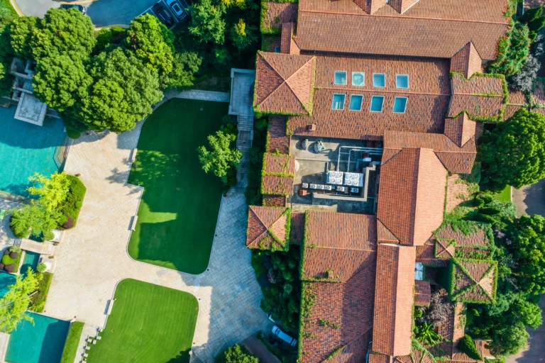
Aerial photos or videos offer valuable perspectives to potential buyers and renters, regardless of the type of property being marketed: residential, commercial, rural acreage, development site, or off-the-plan development. Yes, in certain cases it is the decisive factor.
You may effectively illustrate your listing’s proximity to significant landmarks and locations by taking photos of it from 15 to 200 feet above the ground. Key commuter roads, beaches, parks, hospitals, shopping centers, bus stops, rail stations, café strips, and schools can all be photographed. Show them instead of merely telling them that it is close.
When comparing the listing’s size to other properties and structures, aerial imagery can further highlight any differences. Furthermore, its layout can be expressed quite well, including the distance from nearby properties, the location of a house on the block, the placement of dams on an acreage, the hardstand on an industrial listing, and the parking lot on a commercial property, for example. Even better, you can have us film from a certain height (for example, 100 feet to replicate views from an apartment window on the tenth floor) to show potential views from an office or apartment window in a high-rise building that hasn’t been built yet.