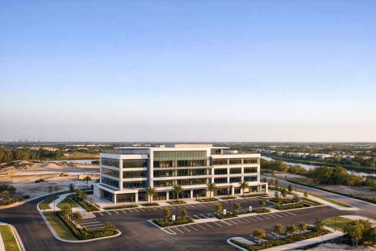
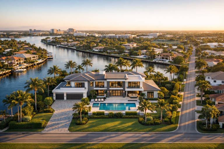
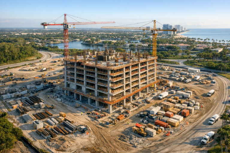
Construction projects move quickly, and once a phase is covered, poured, framed, or paved, it can be difficult to explain exactly what happened on site. Ground-level photos still matter, but they rarely show the full story. Aerial documentation gives owners, developers, contractors, and project teams a clearer view of progress, logistics, access points, staging areas, and surrounding conditions.
For construction teams in Coral Springs, professional drone photography is especially useful because many projects are surrounded by active roads, occupied properties, retail centers, residential areas, drainage features, and tight staging conditions. A well-planned aerial photo set can help decision-makers understand the site without requiring every stakeholder to be physically present.
Effective construction drone photography Coral Springs project teams can rely on is not just about taking attractive images from the sky. It requires safe flight planning, consistent angles, an understanding of construction workflows, and organized deliverables that support real business decisions.
Why Aerial Photography Is Valuable on Construction Projects
Construction documentation has always been important, but many traditional photo records are incomplete. A superintendent may have hundreds of phone photos, yet those images often focus on small areas and lack context. Drone photography adds perspective by showing how each part of the site relates to the whole project.
From above, stakeholders can evaluate site access, material storage, traffic flow, roof progress, exterior work, parking areas, utilities corridors, excavation zones, landscaping progress, and general sequencing. This is especially helpful when teams need to communicate with owners, investors, architects, engineers, lenders, municipal representatives, or off-site executives.
Aerial photos also create a visual timeline. When captured consistently over the life of a project, they help document visible progress from clearing and site preparation through vertical construction, exterior completion, paving, and final presentation.
What Professional Construction Drone Photography Should Capture
A useful drone photo set is planned with the project purpose in mind. The right angles for a weekly progress update may be different from the right angles for marketing, investor reporting, or closeout documentation.
Overall Site Context
Wide aerial images show the full property, surrounding roads, neighboring buildings, access points, and major work areas. These images are valuable for project owners and stakeholders who need to understand the full scope at a glance.
Progress From Consistent Viewpoints
Repeating key angles over time is one of the most important parts of construction drone documentation. Consistent viewpoints make it easier to compare progress from week to week or month to month. This is far more useful than random aerial images taken from different heights and directions each visit.
Top-Down Views
Vertical overhead photos can help show layout, staging, roof conditions, paving progress, drainage areas, and site organization. While standard drone photography is not a substitute for a licensed survey or engineered measurement deliverable, top-down images can improve visual understanding and support coordination discussions.
Oblique Angles for Communication
Oblique aerial photos are captured at an angle rather than straight down. These are often the most useful images for presentations because they show elevation, depth, surrounding context, and visual progress in a way that is easy for non-technical stakeholders to understand.
Detail-Oriented Area Coverage
Some projects require focused images of specific zones, such as roof sections, exterior facades, access drives, retention areas, parking lots, equipment staging, or hardscape installation. A qualified drone operator should understand how to capture these views safely without interfering with construction activity.
How Coral Springs Projects Benefit From Drone Documentation
Coral Springs has a mix of commercial corridors, office properties, retail centers, multifamily communities, civic spaces, schools, and residential neighborhoods. Construction sites in this environment often require careful coordination because activity may be visible to nearby businesses, residents, pedestrians, and drivers.
Drone photography can help project teams document how the site is organized in relation to surrounding properties. For example, aerial images can show where temporary fencing is installed, how deliveries access the site, where equipment is staged, how parking areas are affected, and how exterior work is progressing along property boundaries.
For developers and commercial real estate professionals, aerial photography also helps communicate project momentum. A site that may look complicated from the ground can appear much more understandable from above, especially when images clearly show building placement, parking layout, landscaping progress, and proximity to major roads or amenities.
Construction Progress Photography: One-Time vs. Recurring Flights
Not every project needs the same level of documentation. Some teams need a one-time update before a milestone meeting. Others need recurring aerial photography throughout the build.
One-Time Project Documentation
A single drone photography session may be useful for pre-construction site conditions, milestone documentation, marketing updates, investor presentations, or final completion imagery. This option works well when the goal is to capture a specific moment in the project timeline.
Recurring Progress Photography
Recurring flights are better for projects where visual history matters. Weekly, biweekly, or monthly aerial photos can help show the pace of construction and create a reliable record over time. Consistent scheduling also makes it easier to align drone photography with owner meetings, pay applications, project reports, or marketing campaigns.
The best schedule depends on the size of the project, the speed of construction, and how often stakeholders need updates. Fast-moving exterior phases may benefit from more frequent documentation, while slower phases may require less frequent aerial coverage.
What to Expect From a Professional Drone Photography Workflow
A professional workflow begins before the drone ever leaves the ground. Construction sites are dynamic environments, and a safe, useful flight requires planning.
Pre-Flight Planning
The drone operator should understand the site location, requested deliverables, areas of interest, active work zones, access instructions, and any known site restrictions. For commercial operations, the pilot must also evaluate airspace, weather, visibility, temporary restrictions, nearby obstacles, and operational safety considerations.
On-Site Coordination
Good coordination reduces disruption. The drone pilot should communicate with the appropriate site contact, avoid interfering with crews, maintain safe operating distances, and avoid unnecessary flight over people. On active construction sites, timing matters. Flights are often most effective when they are planned around major deliveries, crane activity, concrete pours, or other operations that may limit safe flight paths.
Image Capture
The actual photo session should include a planned mix of wide views, consistent progress angles, top-down imagery, and focused details based on the project goals. Lighting, sun direction, shadows, and weather conditions can affect final image quality, so timing should be considered whenever possible.
Delivery and Organization
Construction teams benefit from organized files. Images should be delivered in a practical format, with clear separation by date or project phase when applicable. For recurring documentation, consistent file organization can save time for project managers, marketing teams, and owners reviewing the photos later.
Safety, Compliance, and Professional Standards Matter
Drone photography on construction sites should never be treated casually. Commercial drone operations in the United States must be conducted by a pilot operating under FAA Part 107 regulations or an applicable authorization. This matters because construction sites often include people, equipment, vehicles, cranes, temporary structures, power lines, and changing conditions.
A professional drone services company should evaluate whether the site is in controlled airspace, whether authorization is required, and whether weather or site conditions make the flight unsafe. The operator should also understand privacy considerations, especially when working near occupied buildings, neighboring homes, schools, or public areas.
Experience matters because the value of construction drone photography depends on both image quality and judgment. The right provider knows when to reposition, when not to fly, how to stay clear of active operations, and how to capture images that are useful without creating unnecessary risk.
How to Choose a Construction Drone Photography Provider in Coral Springs
When comparing drone companies, look beyond the photo gallery. Construction work requires reliability, communication, and an understanding of what project teams actually need.
Important questions to ask include:
- Is the drone pilot FAA Part 107 certified for commercial operations?
- Does the company understand active construction site safety?
- Can they capture repeatable progress angles over time?
- Do they provide high-resolution images suitable for documentation and marketing?
- Can they coordinate with a superintendent, project manager, or property contact?
- Do they understand South Florida weather, lighting, and site conditions?
- Can deliverables be organized by date, phase, or project need?
The best provider should be able to explain the process clearly, recommend practical shot types, and help you avoid paying for images that look impressive but do not support your project goals.
Common Uses for Construction Drone Photos
Professional aerial images can serve several purposes across a project lifecycle. Common uses include owner updates, lender documentation, investor reports, municipal presentations, contractor coordination, marketing materials, leasing packages, website updates, social media content, and final project portfolios.
For general contractors, aerial photos can support communication with clients and internal teams. For developers, they help show progress and build confidence among stakeholders. For commercial real estate professionals, they can help present a property in context before, during, or after construction. For architects and engineers, aerial imagery can provide a visual reference for site conditions and exterior progress, while still remaining separate from formal survey or inspection deliverables.
Mistakes to Avoid With Construction Drone Photography
The most common mistake is treating drone photography as an afterthought. If flights are scheduled randomly, the images may be attractive but difficult to compare. Another mistake is capturing only high-altitude views and missing the practical details project teams actually need.
It is also important not to rely on drone photos for purposes they are not designed to serve. Standard aerial photography can be excellent for documentation and communication, but it should not replace required inspections, engineering analysis, surveys, or code compliance reviews.
Finally, avoid working with unqualified operators. A low-cost flight may seem efficient until the images are inconsistent, poorly organized, unsafe, or not suitable for commercial use. Construction projects deserve a professional approach.
FAQ
How often should a construction site be photographed by drone?
The right schedule depends on the project. Many teams choose weekly, biweekly, or monthly flights. Fast-moving phases may benefit from more frequent documentation, while slower phases may only need periodic updates tied to milestones.
Can drone photography be used for construction progress reports?
Yes. Aerial photos are commonly used to supplement progress reports because they provide visual context that ground-level photos may miss. They are especially useful when stakeholders are not regularly on site.
Is construction drone photography the same as surveying?
No. Standard drone photography is primarily used for visual documentation, communication, and marketing. Survey-grade mapping or measurements require specialized workflows, proper controls, and qualified professionals when used for survey purposes.
Can drones fly over active construction workers?
Commercial drone operations must follow applicable FAA rules and safety requirements. A professional pilot should plan flights to avoid unnecessary operations over people and coordinate with the site team to reduce risk.
What weather conditions affect drone photography in Coral Springs?
Rain, strong winds, poor visibility, and thunderstorms can prevent or delay safe drone operations. South Florida weather can change quickly, so scheduling flexibility is important for construction documentation.
What files are typically delivered after a drone photo session?
Most construction photography projects include high-resolution edited images suitable for documentation, reporting, presentations, and marketing. Delivery details should be confirmed in advance based on the project needs.
Bringing Better Visibility to Your Coral Springs Construction Project
Construction drone photography gives project teams a clearer, more complete view of what is happening on site. When captured consistently and safely, aerial images can improve communication, document progress, support stakeholder updates, and create a useful visual record from start to finish.
For Coral Springs contractors, developers, property owners, and commercial real estate teams, working with an experienced FAA Part 107 certified drone company helps ensure the process is professional, compliant, and focused on practical results. Skyview Motions provides commercial drone photography for construction projects throughout South Florida, helping teams capture the images they need to communicate with confidence.
If your project would benefit from clear, organized aerial documentation, Skyview Motions can help plan a construction drone photography approach that fits your site, schedule, and project goals.