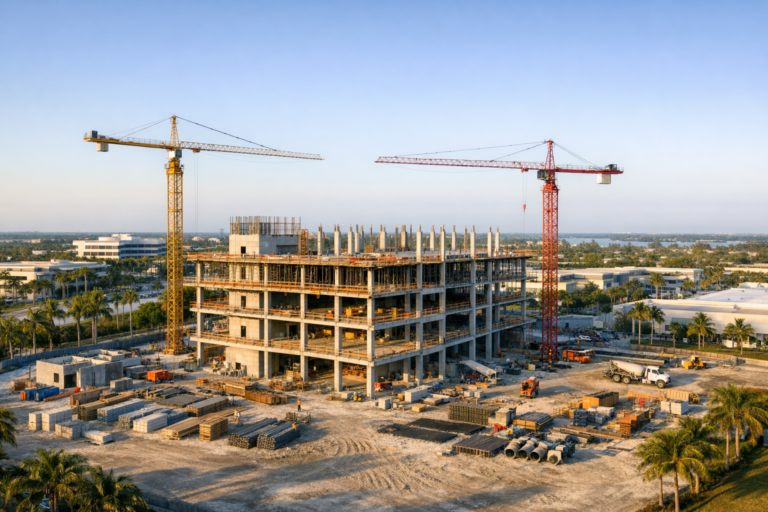
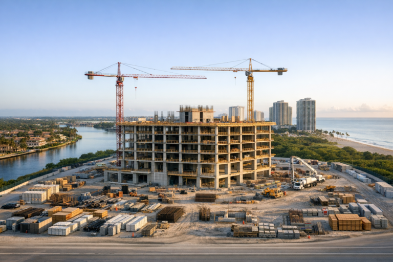
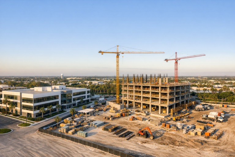
Construction drone photography can do far more than produce impressive aerial images. For project managers, it can become a reliable visual record of site progress, logistics, safety conditions, completed work, staging areas, and changes over time. The difference between useful documentation and a folder of random photos usually comes down to planning.
This construction drone photography checklist is designed for project managers who need consistent, accurate, and easy-to-use aerial documentation. Whether you are preparing monthly owner updates, coordinating with subcontractors, tracking site logistics, or supporting commercial real estate marketing, a clear checklist helps every flight produce images that serve a purpose.
Professional drone work on construction sites requires more than showing up with a drone. Airspace, safety, timing, shot consistency, communication, deliverable formats, and jobsite access all affect the final result. Use the checklist below to plan smarter flights and get more value from every aerial photo session.
Start With The Purpose Of The Drone Photography
Before scheduling a flight, define what the images need to accomplish. Construction drone photography can support several different project needs, but each use case requires a slightly different approach.
Common goals include documenting overall progress, comparing current site conditions to previous milestones, capturing installation phases, reviewing access roads and staging areas, monitoring exterior envelope work, showing roof conditions, or creating presentation images for owners, investors, lenders, or marketing teams.
A project manager should be able to answer three simple questions before the drone team arrives: Who will use the images? What decisions or updates will the images support? Which areas of the site must be documented?
When the purpose is clear, the photographer can prioritize the right angles, altitude, timing, and image style. For example, progress documentation may require repeatable camera positions every month, while marketing photography may require cleaner compositions, better lighting, and fewer active staging distractions.
Pre-Flight Planning Checklist For Project Managers
The most reliable construction drone photography happens before the drone ever leaves the ground. Pre-flight planning reduces delays, improves safety, and helps ensure the final images match the project manager’s expectations.
Confirm Site Access And Point Of Contact
Designate one site contact who can coordinate access, parking, check-in requirements, and communication with the drone operator. On active construction sites, the drone professional should know where to enter, where to stage equipment, and who has authority to approve flight timing.
- Confirm the site address and entrance location.
- Identify the on-site point of contact.
- Clarify whether the drone operator must attend a safety orientation.
- Confirm personal protective equipment requirements.
- Provide any site-specific rules or restricted areas.
Review FAA And Airspace Requirements
Commercial drone operations in the United States must be conducted by a properly certified remote pilot under FAA Part 107. Depending on the location, flights may also require airspace authorization, especially near airports or controlled airspace. Temporary flight restrictions, weather, nearby helipads, and site conditions can also affect the schedule.
Project managers do not need to manage these regulatory details themselves, but they should hire a drone company that understands them. A professional operator will evaluate airspace, comply with operational limitations, monitor weather, and avoid flying when conditions are not safe or compliant.
Coordinate With The Site Team
Drone work should not surprise the people on site. Let superintendents, safety managers, security teams, and relevant subcontractors know when the flight is scheduled. This helps avoid confusion and allows the drone operator to plan around cranes, lifts, concrete pours, deliveries, or other critical activities.
If the site includes sensitive work areas, nearby residences, occupied buildings, or traffic corridors, those details should be discussed before the flight. Good coordination minimizes interruptions and helps keep the operation professional.
Build A Shot List Before The Flight
A shot list turns a general request for aerial photos into a practical production plan. It also helps maintain consistency across weekly, biweekly, or monthly flights.
A strong construction drone photography shot list should include both wide overview images and specific detail areas. The goal is to capture enough context for stakeholders who are not visiting the site in person.
Essential Construction Drone Photos To Capture
- Full-site overhead image showing the entire property and surrounding context.
- Oblique aerial views from each major direction, such as north, south, east, and west.
- Primary building elevation views to show exterior progress.
- Roof, slab, foundation, or structural progress when visible and safe to capture.
- Site logistics, including access roads, laydown areas, material storage, and equipment zones.
- Parking areas, utility corridors, drainage areas, and perimeter conditions when relevant.
- Before-and-after views from consistent angles for milestone comparisons.
- Presentation-quality images for ownership, investor, lender, or marketing updates.
For larger projects, divide the site into zones. This prevents missed areas and makes the final image library easier to organize. For example, a mixed-use development may need separate aerial sets for the garage, residential tower, retail frontage, amenity deck, and surrounding infrastructure.
Prioritize Consistency For Progress Tracking
One of the biggest advantages of drone photography is the ability to show change over time. However, progress tracking is only useful when images are captured consistently.
Whenever possible, use repeatable views from similar altitudes, angles, and directions. This makes it easier to compare the site from one flight to the next. Consistency is especially valuable for monthly owner reports, construction meetings, lender updates, and dispute avoidance documentation.
For example, a project manager may request the same four corner views and one top-down site overview every month. Over time, these repeated images create a visual timeline that clearly shows structural progress, exterior enclosure, sitework, landscaping, and completion milestones.
Lighting and time of day also influence consistency. Morning flights may reduce heat haze and produce clean shadows, while afternoon flights may better illuminate specific elevations. In South Florida, weather can change quickly, so flexibility is important, especially during rainy season.
Schedule Drone Photography Around Site Conditions
Timing matters. The best flight window depends on the purpose of the images, site activity, weather, and safety conditions.
For progress documentation, choose a recurring schedule that aligns with reporting cycles. Many teams prefer monthly flights, while fast-moving projects may benefit from weekly or biweekly documentation. For milestone photography, schedule around meaningful construction phases such as foundation completion, topping out, exterior installation, roof completion, or final sitework.
Weather should always be part of the plan. High winds, heavy rain, poor visibility, and lightning risk can make drone flights unsafe. In South Florida, afternoon storms are common during certain months, so morning flight windows are often more dependable. A professional drone operator should monitor conditions and communicate if rescheduling is the safest option.
Jobsite Safety Checklist For Drone Operations
Construction sites are dynamic environments. Drone flights must be planned with the same seriousness as any other site activity.
- Confirm the drone operator is commercially qualified and insured.
- Identify takeoff and landing areas away from workers, equipment, and vehicle paths.
- Discuss active cranes, lifts, power lines, and overhead obstructions.
- Avoid flying directly over people or moving vehicles unless the operation meets applicable FAA requirements.
- Coordinate with site safety personnel when needed.
- Pause or postpone flights during unsafe weather or high-risk site activity.
- Maintain clear communication between the drone operator and site contact.
A qualified drone team should not interfere with construction operations. The goal is to document the site efficiently while respecting safety procedures, site productivity, and regulatory responsibilities.
Deliverables Checklist: What To Request After The Flight
Useful drone photography does not end with image capture. Project managers should also clarify how the final files will be delivered, organized, and used.
Before the flight, confirm whether you need edited images, unedited documentation images, folder organization by date or site zone, file naming conventions, or resized images for reports and presentations. If marketing use is expected, discuss image polish, composition, and final resolution requirements.
For most construction projects, a practical deliverable package may include a curated set of high-resolution edited images, a broader documentation gallery, and organized folders labeled by flight date. Consistent naming and organization can save time when building reports or comparing progress over several months.
Common Mistakes To Avoid
Project managers can prevent most drone photography problems by avoiding a few common mistakes.
- Scheduling a flight without defining the purpose of the images.
- Requesting photos too late after a milestone has been covered or changed.
- Failing to notify the superintendent or safety team.
- Using different angles every time and losing progress comparison value.
- Ignoring weather, sun direction, or site activity when choosing flight time.
- Not confirming deliverable expectations before the shoot.
- Hiring based only on price instead of safety, experience, and professionalism.
The best drone photography programs are organized, repeatable, and aligned with the project’s communication needs. A little planning produces a much more valuable visual record.
FAQ: Construction Drone Photography Checklist
How often should a construction project be photographed by drone?
It depends on the project pace and reporting needs. Monthly flights are common for owner and lender updates. Weekly or biweekly flights may be useful for fast-moving sites, complex logistics, or projects with frequent stakeholder reporting.
What should be included in a construction drone photography checklist?
A complete checklist should include project goals, site access, point of contact, airspace review, safety requirements, shot list, timing, weather considerations, repeatable progress views, and final deliverable expectations.
Do construction drone flights require an FAA-certified pilot?
Yes. Commercial drone photography in the United States must be performed by a remote pilot operating under FAA Part 107 requirements. Additional airspace authorization may be needed depending on the project location.
Can drone photos replace traditional site documentation?
Drone photos are best used as a supplement to ground-level documentation, reports, inspections, and project management records. Aerial images provide context and visibility that ground photos often cannot, but they do not replace required inspections or professional evaluations.
What is the best time of day for construction drone photography?
The best time depends on the site and the purpose of the images. Morning often provides stable conditions and clean light, while other times may better illuminate certain elevations. Weather, shadows, and active construction operations should all be considered.
Make Drone Photography A Reliable Project Management Tool
A well-planned construction drone photography checklist helps project managers capture more than attractive aerial views. It creates a repeatable process for documenting progress, communicating clearly with stakeholders, and preserving a visual record of important milestones.
The most valuable results come from combining clear project goals, safe flight planning, consistent shot angles, organized deliverables, and an experienced commercial drone operator who understands construction environments.
Skyview Motions provides FAA Part 107 certified commercial drone photography and videography for construction projects across South Florida. If your team needs consistent progress documentation, milestone photography, or professional aerial visuals for project updates, our team can help plan and capture the right images from the start.