Construction projects move quickly, but the true scale of that progress is not always easy to show from the ground. A foundation pour, vertical framing, roof installation, site grading, exterior finishes, and final completion may each represent major milestones, yet ground-level photos often capture only fragments of the story.
That is where before and after construction drone photography becomes especially valuable. Aerial images create a clear visual record of how a site changes over time. They help project teams communicate progress, support reporting, strengthen marketing, and preserve documentation that can be useful long after the project is complete.
For developers, general contractors, construction managers, architects, engineers, and property owners, professional drone photography is not just about impressive visuals. When planned properly, it becomes a practical tool for decision-making, accountability, and project communication.
Why Aerial Before-and-After Photos Are Different From Ground Photos
Ground photography is useful, but it has limitations. A person standing on a jobsite can only photograph what is visible from their position. Obstructions, fencing, equipment, neighboring structures, and limited access can prevent a complete view of the work.
A drone can capture the full context of a project from above. It can show the relationship between the building footprint, access roads, parking areas, drainage features, staging zones, landscaping, and surrounding properties. This perspective is especially important on commercial projects where site layout, sequencing, and exterior improvements matter as much as the structure itself.
Before-and-after aerial photos make change easy to understand. A single comparison can show what existed before construction began, what was added, what was removed, and how the final site fits into its environment. For busy stakeholders who may not visit the jobsite regularly, that visual clarity is hard to match.
What Before-and-After Construction Drone Photography Can Document
The strongest before-and-after photo sets are planned around meaningful project milestones. Instead of capturing random images, a professional approach focuses on phases that matter to the project team.
Pre-Construction Site Conditions
Aerial photos taken before work begins can document site conditions, neighboring properties, existing structures, vegetation, access points, parking areas, stockpiles, and surrounding roadways. These images provide a valuable baseline for comparison later in the project.
For example, a developer may want to show how an underutilized parcel was transformed into a retail center, multifamily property, industrial facility, or office building. A pre-construction aerial image makes that transformation visible in one frame.
Major Construction Milestones
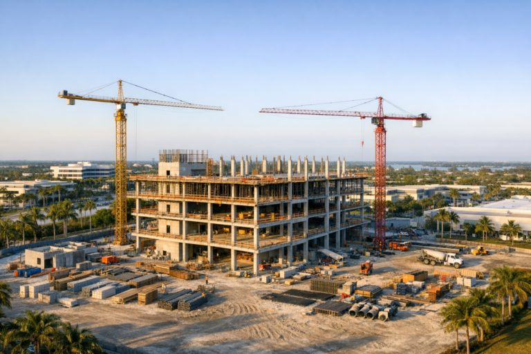
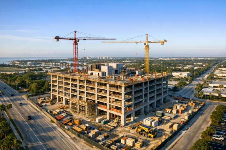
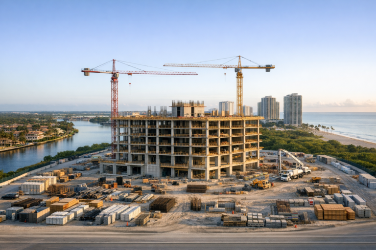
Drone photography can document grading, foundation work, structural framing, roofing, exterior envelope installation, paving, landscaping, and final completion. When captured from consistent angles, these milestones create a visual timeline that is easy to understand and easy to share.
This is particularly helpful for project owners, investors, lenders, and corporate teams who need regular updates but may not be present on site. A well-composed drone image can communicate progress faster than a long written summary.
Final Completion and Project Closeout
Final aerial photos are often used for marketing, portfolio development, leasing materials, project presentations, and internal records. When paired with earlier images, they show the full construction journey from raw site or early-stage conditions to a finished asset.
These final images can also help general contractors, architects, engineers, and developers demonstrate the quality and scope of their work in proposals, case studies, and project recaps.
How Before-and-After Aerial Photos Improve Project Communication
Clear communication is one of the biggest challenges in construction. Stakeholders often have different levels of technical knowledge, different priorities, and different access to the site. Aerial photography helps create a shared visual reference.
For a construction manager, drone photos can support weekly or monthly progress updates. For an owner, they provide confidence that visible progress is being made. For a marketing team, they create visual assets that can be used before the project is finished. For architects and engineers, they offer broader context for how the design is taking shape on the site.
Before-and-after comparisons are especially effective because they reduce confusion. Instead of asking someone to interpret a schedule, site log, or written report alone, the project team can show the transformation directly.
Practical Business Uses Beyond Progress Updates
Many companies first think of drone photos as marketing assets, but their value extends further. A well-organized aerial photo archive can support multiple business needs throughout the life of a project.
Marketing and Business Development
Before-and-after imagery helps construction and real estate professionals tell a stronger story. It can show the scale of a project, the difficulty of a site, the quality of finished work, and the transformation delivered by the project team.
Commercial real estate teams can use aerial comparisons to promote redevelopment projects, retail centers, mixed-use properties, industrial sites, and hospitality assets. Contractors can use them to strengthen proposals by visually demonstrating experience on similar projects.
Owner and Investor Reporting
Owners and investors want confidence that a project is moving forward. Aerial progress comparisons provide an efficient way to summarize what has changed since the previous phase. They can complement written reports, schedule updates, and budget discussions without replacing them.
Historical Project Records
Once a project is complete, it can be difficult to recreate the construction history. A structured drone photo archive preserves that history. Years later, these images may still be useful for internal presentations, future renovations, property management, insurance discussions, or marketing refreshes.
What Makes a Strong Before-and-After Drone Photo Set
Not every aerial image is equally useful. The quality of before-and-after construction drone photography depends on planning, consistency, safety, and an understanding of the project goals.
Consistent Angles and Altitudes
Before-and-after images are most effective when they are captured from similar viewpoints. Consistent angles, altitude, framing, and orientation make visual comparison easier. If the before photo looks north from one corner of the site and the after photo looks south from a different height, the comparison loses impact.
A professional drone operator will plan repeatable vantage points whenever practical. This can include wide establishing shots, oblique angles from each corner, straight-down orthographic-style views, and closer detail shots of important site features.
Good Timing and Lighting
Lighting affects both image quality and clarity. Harsh midday light can create heavy contrast, while early morning or late afternoon light may add depth and dimension. On active construction sites, timing also matters for safety, site access, equipment movement, and minimizing disruption.
In South Florida, weather is another practical consideration. Wind, rain, storms, and rapidly changing cloud cover can affect drone operations. Planning with some scheduling flexibility helps protect both safety and image quality.
Clear Project Objectives
The best results come from knowing how the images will be used. A marketing team may want polished hero images and dramatic transformation shots. A construction manager may need consistent documentation from fixed points. A developer may want both site-wide views and surrounding context for investor updates.
Defining those goals before the flight helps ensure the final deliverables are useful rather than just visually appealing.
Safety, FAA Compliance, and Professional Standards Matter
Construction sites are complex environments. Drones should be operated with careful attention to safety, airspace requirements, people on site, equipment movement, and property boundaries. Commercial drone operations in the United States generally require an FAA Part 107 remote pilot certificate, and specific operating conditions may require additional planning or approvals.
Professional drone work also involves more than flying the aircraft. It includes pre-flight planning, checking airspace, evaluating weather, coordinating with site contacts, maintaining visual awareness, and avoiding unsafe flight paths over active work areas whenever possible.
Hiring a qualified commercial drone provider helps reduce risk and improves the reliability of the final product. For construction projects, that professionalism is especially important because jobsite activity changes constantly.
How Often Should Construction Projects Schedule Drone Photography?
The right schedule depends on project size, duration, reporting needs, and budget. A small commercial build may only need pre-construction, midpoint, and completion coverage. A larger development may benefit from monthly, biweekly, or milestone-based drone photography.
For many commercial construction projects, milestone-based coverage is the most efficient approach. Flights can be scheduled around visible phases such as site clearing, foundation completion, vertical construction, roof completion, exterior finishes, paving, landscaping, and final turnover.
Recurring flights offer the strongest before-and-after comparisons because they build a visual timeline. Even if the final goal is a dramatic before-and-after image, intermediate progress photos often become valuable for communication and documentation along the way.
Common Mistakes to Avoid
One common mistake is waiting until the project is nearly finished. Without a true beginning point, the final comparison is less powerful. Capturing the site before mobilization or early in the process creates a stronger record.
Another mistake is relying on inconsistent, informal photos taken by different people at different times. While those images may be useful internally, they often lack the consistency and quality needed for professional reporting or marketing.
It is also important not to treat drone imagery as a replacement for surveys, engineering inspections, or official project controls unless those services are specifically being provided by qualified professionals using appropriate methods. Standard drone photography is best understood as visual documentation, communication support, and marketing content.
Why South Florida Construction Projects Benefit From Aerial Documentation
South Florida construction sites often involve dense development patterns, waterfront properties, commercial corridors, active roads, limited staging areas, and weather-sensitive scheduling. Aerial documentation can help show how a project fits within these conditions.
For commercial real estate, drone photography can also highlight location advantages such as visibility, access, surrounding development, parking, landscaping, and proximity to major roads or coastal features. These details are difficult to communicate from the ground alone.
For contractors and developers working in competitive markets, strong visual documentation can help demonstrate professionalism and make completed projects easier to present to future clients, tenants, investors, and partners.
FAQ
What is before and after construction drone photography?
It is the use of aerial drone images to document a construction site at different stages, usually comparing early site conditions with later milestones or final completion. The goal is to clearly show progress and transformation from a consistent aerial perspective.
When should the first drone photos be taken?
Ideally, the first photos should be captured before construction begins or as early as possible. This creates a baseline that makes later progress and final completion comparisons much more meaningful.
How many before-and-after angles are needed?
Most projects benefit from several repeatable angles. A typical set may include wide views from multiple corners, a top-down site view, and closer images of important features. The exact number depends on the size and complexity of the project.
Can drone photos be used for construction marketing?
Yes. High-quality aerial photos are excellent for project portfolios, proposals, social media, website content, presentations, leasing materials, and investor updates. Before-and-after images are especially useful because they show the value created by the project team.
Do commercial construction drone flights require a licensed pilot?
Commercial drone operations in the United States generally require an FAA Part 107 certified remote pilot. Construction sites also require careful planning for safety, coordination, weather, airspace, and site activity.
Stronger Project Stories Start With Better Documentation
Before-and-after aerial photos are powerful because they make construction progress easy to see, understand, and share. They turn months of planning, labor, coordination, and problem-solving into a clear visual story that supports communication, marketing, reporting, and long-term project records.
For the best results, construction drone photography should be planned early, captured consistently, and aligned with the needs of the project team. The difference between random aerial photos and useful project documentation comes down to experience, preparation, and attention to detail.
Skyview Motions provides professional commercial drone photography and videography for construction projects throughout South Florida. For developers, contractors, property owners, and project teams that need clear, reliable aerial documentation, a well-planned before-and-after photo strategy can help present every stage of the project with confidence.