Construction projects move quickly, and once work is covered, enclosed, paved, or finished, the opportunity to document it is gone. That is why a thoughtful photo record is more than a marketing asset. It is part of how owners, developers, contractors, and consultants communicate progress, verify conditions, reduce misunderstandings, and keep a project moving.
In Fort Lauderdale, construction progress photography has unique considerations. Dense urban corridors, coastal weather, canal-side properties, high-rise work, tight staging areas, and active commercial districts all affect how a jobsite should be documented. A casual set of photos is rarely enough. The most useful photo documentation follows a repeatable plan, captures the right details at the right time, and gives stakeholders a clear visual record they can trust.
If you are planning construction progress photography in Fort Lauderdale, the key question is not simply how often to take photos. It is what to document, why it matters, and how to make the images useful months or even years later.
Why Construction Progress Photography Matters
Progress photos help project teams see what is happening without requiring every stakeholder to visit the site. For owners and investors, images provide confidence that work is advancing. For general contractors and construction managers, they support coordination and reporting. For architects, engineers, and consultants, they help verify visible progress and site conditions. For marketing teams, they create a professional archive that can support future presentations, leasing campaigns, and case studies.
Good documentation can also help when questions arise. Photos may show when materials arrived, how access was maintained, what areas were open or obstructed, whether site conditions changed after a storm, or how a specific phase looked before the next trade covered it. While photographs do not replace formal inspections, surveys, or contract documentation, they provide a practical visual reference that can be valuable throughout the project lifecycle.
Start With a Documentation Plan
The best results come from planning before the first flight or camera session. A construction progress photography plan should define the purpose of the documentation, the key areas to capture, the preferred angles, the schedule, and how the final images will be delivered.
For example, a developer may need consistent aerial images for monthly investor updates. A general contractor may want weekly drone photographs from the same viewpoints to compare site progress. A property owner may need wide establishing images plus focused documentation of site access, laydown areas, parking impact, and surrounding conditions.
Before photography begins, identify who will use the images and what decisions they need to support. That answer determines what should be documented.
What to Document on a Fort Lauderdale Construction Site
A complete photo record should include both broad context and specific details. Drone photography is especially useful for showing the full site, surrounding access, and the relationship between building progress and site logistics. Ground-level images can complement drone photos by capturing close-up details that are not visible from the air.
Overall Site Context
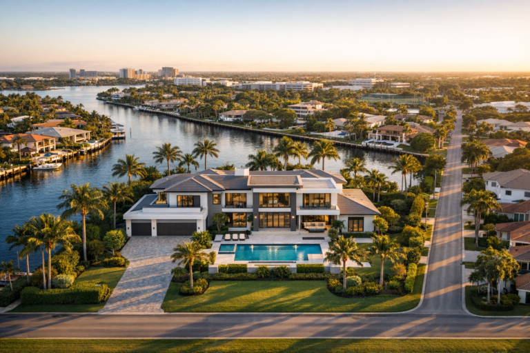
Begin with wide aerial views that show the entire property and its surroundings. These images help stakeholders understand how the project fits within neighboring roads, waterways, buildings, parking areas, and staging zones.
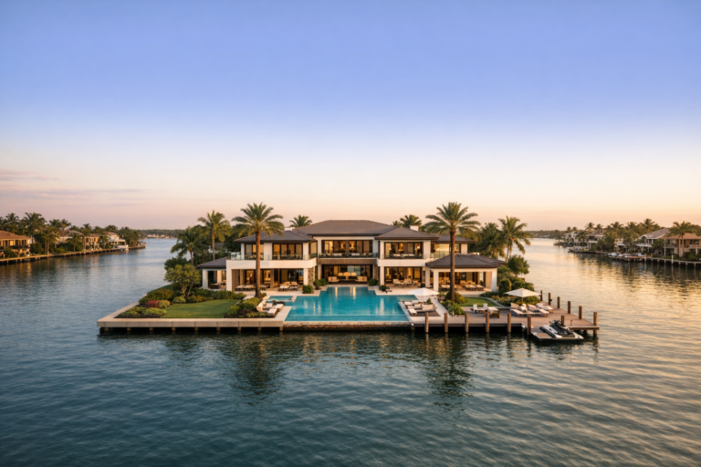
In Fort Lauderdale, this often means documenting nearby canals, Intracoastal-adjacent properties, downtown streets, beach-area access, or constrained urban lots. Wide context images are particularly useful before major work begins because they create a baseline record of existing site conditions.
Consistent Repeat Angles
Repeatable viewpoints are one of the most valuable parts of construction progress photography. Capturing the same angles at regular intervals makes it easier to compare progress over time. These can include north, south, east, and west aerial views, an overhead site view, and several oblique angles that show building elevation and depth.
Consistency matters. If every photo session uses different altitudes, directions, and framing, stakeholders have to work harder to understand what changed. A repeatable visual sequence makes progress obvious.
Site Preparation and Earthwork
Early construction activity is easy to overlook, but it is often some of the most important work to document. Photos should capture clearing, demolition, grading, excavation, dewatering areas when visible, temporary fencing, access points, erosion controls, and initial site logistics.
For properties in South Florida, documenting site drainage conditions and how the jobsite is organized can be especially useful after heavy rain or seasonal storms. Images can help teams understand how water, equipment, and materials are moving through the site.
Foundations and Structural Milestones
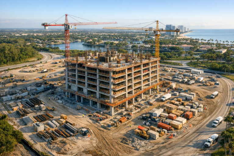
Major milestones should be photographed before they are hidden by later work. This includes foundation preparation, slab placement, structural framing, vertical concrete progress, steel erection, roof installation, and major envelope work.
Aerial images are helpful for showing the footprint and overall advancement of these phases, while ground images may capture details such as formwork, reinforcing activity, penetrations, material staging, and visible trade progress. The goal is not to replace inspection records, but to create a clear visual timeline of the project’s physical development.
Building Envelope and Exterior Progress
For commercial buildings, multifamily developments, hospitality properties, and mixed-use projects, the exterior tells an important story. Document façade installation, glazing, waterproofing progress where visible, roofing, balconies, exterior finishes, canopies, signage areas before final installation, and site hardscape.
Exterior progress photos are especially useful for owner reporting and marketing because they show the project becoming recognizable. They also help remote stakeholders see whether visible work is tracking with expectations.
Site Logistics, Access, and Safety Conditions
Useful construction documentation should also show how the site is functioning. Capture gates, access roads, pedestrian routes near the site, crane or lift locations, material laydown areas, dumpsters, temporary offices, parking impacts, and traffic flow where appropriate.
These images can be helpful in Fort Lauderdale’s tighter commercial corridors, where staging and access are often limited. If a project is near active businesses, residences, beaches, or high-traffic roads, documenting site logistics can provide valuable context for coordination meetings.
Surrounding Property Conditions
Before major work begins, it may be valuable to document adjacent visible conditions from permitted and safe vantage points. This can include neighboring structures, sidewalks, pavement, curbs, landscaping, fencing, and drainage areas.
This type of documentation should be done carefully and professionally, respecting privacy and applicable flight rules. The objective is to record relevant visible site context, not to intrude on neighboring properties.
Weather and Storm-Related Conditions
South Florida weather can change jobsite conditions quickly. After significant rain or wind, photo documentation can help show standing water, material displacement, access limitations, visible erosion, or changes to staging areas.
Photos taken before and after a storm event can be useful for internal records and communication. Drone operations, however, should only take place when conditions are safe and compliant. Wind, rain, lightning, airspace restrictions, and site hazards must all be considered before any flight.
How Often Should Progress Photos Be Taken?
The right schedule depends on the project size, pace, and reporting needs. Monthly photography may be enough for a slower-moving owner update. Weekly documentation is common for active commercial sites where visible progress changes quickly. Some projects benefit from milestone-based photography tied to excavation, foundation, topping out, dry-in, façade completion, paving, and final site work.
For high-value projects, the most effective approach is often a combination: regularly scheduled aerial photography plus additional sessions at critical milestones. This provides both a consistent timeline and targeted documentation of important phases.
Drone Photography Considerations in Fort Lauderdale
Professional drone work on construction sites requires more than a camera in the air. Commercial drone operations must be conducted by a properly certified remote pilot under FAA Part 107 requirements. Depending on the location, flights may also require awareness of controlled airspace, nearby airports or heliports, temporary flight restrictions, people and vehicle movement, and site-specific safety rules.
Fort Lauderdale projects can present added complexity because of urban density, coastal winds, nearby aviation activity, and active roads or pedestrian areas. A professional drone provider should evaluate the site before flying, coordinate with the project team, maintain visual line of sight, avoid unsafe operations over people or moving vehicles unless permitted under applicable rules, and prioritize safety over capturing a shot.
Reliable progress photography also depends on image quality and organization. Images should be sharp, properly exposed, consistently framed, and delivered in a format that is easy for the project team to review, archive, and share.
What Makes Progress Photos Useful After Delivery?
The value of construction photography increases when images are organized clearly. A folder full of random files can be difficult to use later. A better delivery process includes dates, logical file organization, consistent viewpoint naming when applicable, and a selection of both wide and detailed images.
For recurring projects, teams should be able to compare one month to the next without guessing which angle they are looking at. Clear organization helps owners, contractors, and consultants quickly find the images they need for meetings, reports, and records.
Common Mistakes to Avoid
- Only photographing the most attractive angle. Marketing images are useful, but documentation should also capture practical jobsite realities.
- Changing viewpoints every session. Inconsistent framing makes progress harder to compare.
- Waiting too long between sessions. Important work may be covered, removed, or changed before it is documented.
- Ignoring site context. Access, staging, neighboring conditions, and logistics often matter as much as the structure itself.
- Hiring without verifying commercial drone qualifications. Construction sites require safe, compliant, professional operations.
FAQ
What should be included in construction progress photography?
A strong progress photo set should include wide site views, consistent repeat angles, current building progress, site access, staging areas, major milestones, surrounding conditions, and any visible items relevant to the project team’s reporting needs.
Is drone photography better than ground photography for construction documentation?
Drone photography is excellent for overall site context, logistics, and progress comparison. Ground photography is better for close details. Many projects benefit from using both, depending on the purpose of the documentation.
How often should a Fort Lauderdale construction site be photographed?
Many commercial projects use weekly or monthly photography, with additional sessions at major milestones. Fast-moving projects or projects with frequent stakeholder reporting usually benefit from a more consistent schedule.
Do construction drone photos count as inspections?
No. Drone photos can support visual documentation and communication, but they do not replace required inspections, engineering evaluations, surveys, or official compliance reviews.
Why hire a professional drone company instead of taking photos internally?
A professional drone company brings flight experience, Part 107 certification, site safety awareness, consistent capture methods, and organized deliverables. That helps create a more reliable record while reducing operational risk on an active jobsite.
Build a Better Visual Record of Your Project
Construction progress photography is most valuable when it is planned, consistent, and focused on the information stakeholders actually need. In Fort Lauderdale, where weather, access, density, and coastal conditions can all influence construction, professional documentation helps turn day-to-day activity into a clear visual timeline.
Skyview Motions provides commercial drone photography and videography for construction projects throughout South Florida, including progress documentation designed for owners, developers, general contractors, and project teams. If your project needs reliable aerial documentation, a thoughtful capture plan can help you preserve the right details from start to finish.