Large properties are difficult to understand from the ground. A row of exterior photos may show a building clearly, but it rarely explains the full property: how the land is laid out, where access points are located, how parking flows, what sits nearby, or how much usable space exists beyond the front entrance.
That challenge is even greater in South Florida, where commercial sites, waterfront estates, resorts, industrial properties, development parcels, agricultural land, and mixed-use assets often depend on features that only make sense from above. Aerial real estate photography gives buyers, tenants, investors, developers, and decision-makers the visual context they need before visiting a site in person.
For large properties, professional drone photography is not simply about creating dramatic images. It is about communicating scale, location, access, condition, and opportunity in a way ground-level photography cannot.
Large Properties Need Context, Not Just Attractive Photos
Most real estate photography focuses on curb appeal, interiors, amenities, and detail shots. Those images are important, but they often fail to answer the first questions a serious commercial buyer or project stakeholder has: How large is the property? How is it positioned? What surrounds it? How easy is it to access? What gives it strategic value?
Aerial imagery answers those questions quickly. From an elevated perspective, viewers can see the relationship between buildings, parking areas, service roads, landscape features, adjacent properties, drainage areas, waterfront, undeveloped land, and nearby roadways. This broader view helps people understand the asset as a complete site rather than a collection of individual photos.
For commercial real estate, that context can improve listing presentations, investment packages, leasing materials, development proposals, and internal decision-making. For owners and managers, it also creates a clear visual record of the property at a specific point in time.
What Aerial Photography Reveals on Large South Florida Properties
The value of drone photography becomes especially clear when a property has more to communicate than a building facade. Large properties often include multiple zones, access points, natural features, or operational areas that are hard to capture from street level.
Scale and property layout
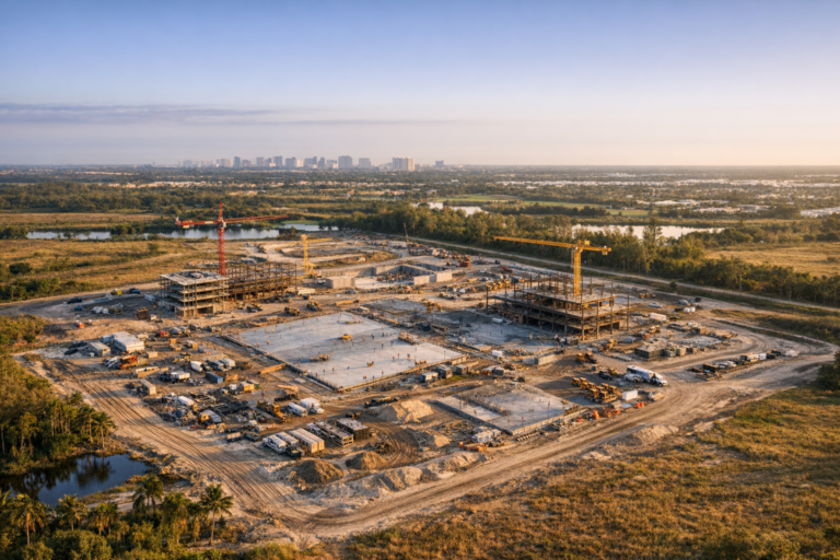
Aerial photography helps viewers understand the size and use of a property at a glance. This is particularly useful for acreage, large commercial campuses, resort properties, marinas, golf courses, warehouses, distribution sites, and development parcels. Aerial images can show the relationship between structures, open land, circulation paths, and surrounding areas in a single frame.
Access, traffic flow, and parking
For commercial properties, access is often as important as appearance. Drone imagery can show driveways, entry points, loading areas, parking capacity, internal roadways, turn lanes, and proximity to major corridors. For example, a warehouse or distribution property may benefit from aerial views that show truck circulation, loading docks, staging areas, and roadway access more clearly than ground images ever could.
Waterfront and environmental features
South Florida properties often gain value from waterfront frontage, canals, retention ponds, preserve areas, golf course adjacency, or ocean and Intracoastal proximity. Aerial real estate photography can show these features in relation to the property rather than treating them as isolated details. This is especially helpful for waterfront commercial real estate, hospitality properties, luxury estates, and land marketed for future development.
Surrounding neighborhood and nearby demand drivers
Location is one of the strongest selling points in real estate, but it can be difficult to communicate with ground photography alone. Aerial images can show proximity to beaches, downtown districts, highways, airports, retail corridors, medical centers, schools, industrial hubs, marinas, and residential communities. That visual context helps out-of-market buyers and investors understand why a site matters.
Development potential and land use
For vacant land or redevelopment sites, drone photography can help stakeholders visualize topography, vegetation, site boundaries, surrounding access, and neighboring uses. While aerial photos do not replace surveys, engineering studies, or due diligence, they provide a practical visual overview that supports early evaluation and marketing.
Why South Florida Properties Benefit So Much from Aerial Views
South Florida is a visually complex market. Many properties sit within dense urban corridors, coastal zones, master-planned communities, or mixed commercial and residential areas. Streets may be lined with landscaping, perimeter walls, signage, trees, vehicles, and neighboring structures that block a complete ground-level view.
The region is also relatively flat, which means traditional ground photography cannot easily capture wide spatial relationships. Aerial photography solves that limitation by lifting the camera above obstructions and providing a clear understanding of how the property fits into its environment.
Weather and light also matter. South Florida sun can create harsh shadows during the middle of the day, while late afternoon light can produce warmer, more dimensional property images. A professional drone operator plans timing, angles, altitude, and shot sequence to produce clean, useful visuals rather than simply flying overhead and taking random photos.
How Aerial Imagery Supports Real Estate Marketing and Business Decisions
High-quality aerial photography serves multiple purposes across the life of a property. It can support marketing, documentation, planning, stakeholder communication, and long-term asset management.
Sales and leasing presentations
For brokers and owners, aerial images help listings stand out while also giving prospects meaningful information. A buyer evaluating a large retail center may want to see parking distribution and road access. A tenant considering industrial space may care about truck movement and nearby highways. A hospitality investor may want to see proximity to beaches, marinas, or entertainment districts.
Investor and lender communication
Large real estate assets often involve people who are not physically present for every site visit. Aerial imagery helps provide a shared visual reference for investors, lenders, partners, and decision-makers. It makes conversations more efficient because everyone can see the same site relationships and property conditions.
Construction and redevelopment documentation
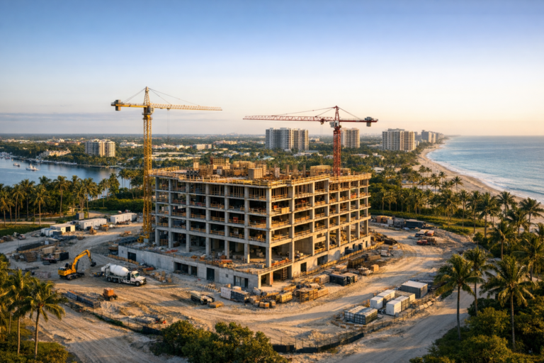
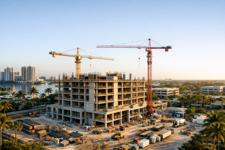
For properties under construction or renovation, recurring drone photography can document progress, site conditions, staging areas, access changes, and completed milestones. These images can assist construction managers, developers, owners, and marketing teams by creating a consistent overview of the project over time.
Property management and asset records
Drone photography can also help with periodic property documentation. Owners and managers may use aerial images to review roof areas, landscaping, parking lots, stormwater features, exterior improvements, and general site condition. This does not replace professional inspections when required, but it provides a useful visual record.
Professional Drone Photography Requires More Than a Drone
Large-property aerial photography should be planned carefully. The difference between casual drone images and professional commercial work comes down to preparation, flight safety, composition, and understanding what the property needs to communicate.
A qualified commercial drone provider should operate under FAA Part 107, evaluate the airspace, review site conditions, plan safe launch and landing areas, and account for people, vehicles, structures, trees, power lines, weather, and nearby airports or controlled airspace. Certain locations or operations may require additional FAA authorization or careful scheduling.
Professional planning also includes identifying the right shot list. A large property may need overhead views, angled hero images, entrance views, boundary-oriented perspectives, amenity shots, roadway context, waterfront angles, and closer detail images. The goal is not to deliver the most images possible. The goal is to deliver the right images for the property’s business purpose.
Practical Tips Before Scheduling Aerial Real Estate Photography
Property owners, brokers, and project teams can help ensure a stronger result by preparing before the drone photography session.
- Clarify the purpose of the images. Marketing a property for sale requires a different shot strategy than documenting construction progress or supporting an investor update.
- Identify key features in advance. Share important access points, boundaries, amenities, waterfront areas, expansion areas, signage, parking zones, or nearby landmarks.
- Prepare the site when possible. Clean visible clutter, move unnecessary vehicles, confirm landscaping condition, and coordinate around deliveries or active work areas.
- Consider timing. Morning or late afternoon light may be more flattering, while some commercial sites benefit from specific traffic or activity patterns.
- Communicate operational constraints. Let the drone team know about security protocols, restricted areas, active construction, roof work, events, or tenant activity.
Good preparation helps the aerial photography session run efficiently and produces images that are more useful for marketing and decision-making.
What to Look for in a Commercial Drone Photography Provider
When hiring a drone company for a large South Florida property, look beyond the ability to fly. The provider should understand commercial objectives, real estate presentation, safe flight operations, and the specific challenges of large sites.
Important factors include FAA Part 107 certification, experience with commercial properties, thoughtful pre-flight planning, clear communication, professional editing, dependable scheduling, and an understanding of how aerial images will be used. A good provider should ask questions before the shoot, not simply arrive and capture generic overhead photos.
For large properties, the best results come from combining technical drone operation with a real understanding of what decision-makers need to see.
FAQ
Is aerial real estate photography worth it for every property?
It is most valuable when the property has meaningful exterior features, land, location advantages, access considerations, development potential, or surrounding context that cannot be fully shown from the ground. Large commercial, waterfront, industrial, hospitality, and development properties are especially strong candidates.
Can drone photography show property boundaries?
Aerial photos can help visually orient a viewer, but they should not be treated as a legal survey unless properly supported by survey data and professional mapping deliverables. For marketing purposes, boundary lines should be handled carefully and accurately.
How long does a drone photography session take?
Timing depends on property size, shot list, site access, airspace considerations, weather, and the number of deliverables needed. A straightforward commercial property may be completed relatively quickly, while a large multi-area site may require more planning and flight time.
What if the property is near an airport?
Many South Florida properties are located near airports or controlled airspace. A professional drone operator will evaluate the location before the shoot and determine whether FAA authorization or other operational planning is needed.
Can aerial photography be combined with video?
Yes. Many large-property marketing campaigns benefit from both still photography and drone video. Photos are useful for listings, brochures, websites, and presentations, while video can guide viewers through the property and surrounding area in a more dynamic way.
Conclusion
Large South Florida properties need more than standard ground-level photography to be understood clearly. Aerial imagery reveals scale, access, layout, surroundings, waterfront features, parking, land use, and development potential in a way that helps buyers, tenants, investors, and project teams make better-informed decisions.
For commercial real estate professionals, developers, property owners, and construction teams, professional drone photography can turn a complex site into a clear visual story. When planned correctly, it does more than make a property look impressive. It helps people understand why the property matters.
Skyview Motions provides FAA Part 107 certified commercial drone photography and videography for large properties throughout South Florida. If you are preparing to market, document, or evaluate a commercial property, a professionally planned aerial session can give your team the clarity and visual impact needed to move forward with confidence.