Location has always been one of the strongest selling points in real estate, but traditional photography often struggles to show it clearly. A ground-level image may capture the lobby, storefront, façade, or parking area, yet it rarely communicates how close the property is to major roads, waterfront districts, retail centers, hotels, parks, schools, restaurants, or walkable destinations.
That is where aerial property photography becomes especially valuable. A professional drone perspective can show the building and its surrounding environment in one visual story. Instead of asking a buyer, tenant, investor, or stakeholder to imagine what is nearby, aerial imagery helps them see the relationship between the property and the amenities that influence demand.
For commercial real estate, hospitality, multifamily, retail, office, industrial, and development properties throughout South Florida, that context can make a listing easier to understand and more compelling to evaluate.
Why Nearby Amenities Matter in Property Marketing
Amenities are not just nice additions. They help define how a property functions in the real world. A retail center near high-traffic corridors, an office building close to restaurants and hotels, a multifamily community near parks and entertainment, or a hospitality property close to beaches and transportation can all benefit from visual context.
When people evaluate a property, they are usually asking practical questions:
- What is around the property?
- How easy is it to access?
- Is the location convenient for customers, tenants, guests, or employees?
- What does the surrounding neighborhood look like?
- Are there visible landmarks or destination points nearby?
- Does the setting support the property’s intended use?
Aerial photography helps answer these questions more quickly than text alone. It can turn a list of nearby amenities into a visual advantage.
How Drone Photography Shows the Bigger Picture
Professional drone imagery gives viewers a wider field of view without losing focus on the property itself. This is important because the goal is not simply to fly high and capture everything. The goal is to compose images that clearly show the property in relation to the features that matter most.
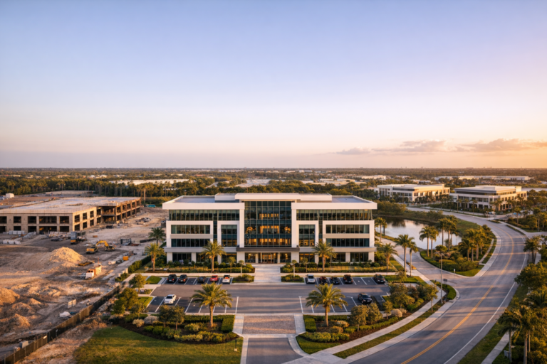
For example, a well-planned aerial image of a commercial building may show the building centered in the frame, the main road leading toward it, nearby restaurants within visual range, adjacent parking, and surrounding development patterns. That single image may communicate convenience, visibility, access, and neighborhood character more effectively than several ground photos.
In South Florida, where waterways, beaches, downtown districts, golf courses, shopping areas, and major roadways often influence property value and appeal, the aerial perspective can be especially useful. A professional drone operator can frame these features honestly and clearly while keeping the property as the primary subject.
Types of Amenities Aerial Photography Can Highlight
The best amenity-focused drone images are customized to the property type and marketing goal. A shopping center does not need the same visual emphasis as a multifamily building, warehouse, resort, or medical office. Before a shoot, it helps to identify which nearby features actually matter to the intended audience.
Transportation and Access
Access is one of the most important factors in commercial property marketing. Aerial photography can show proximity to major roads, intersections, parking areas, bridges, transit stops, airports, ports, and pedestrian routes. For retail and office properties, this can help viewers understand how customers or employees would reach the site. For industrial or logistics properties, roadway access and circulation patterns may be even more important.
Retail, Dining, and Entertainment
Restaurants, cafés, shopping centers, entertainment venues, and mixed-use districts can add meaningful context to office, multifamily, hotel, and retail properties. Aerial images can show how close these destinations are without relying only on map screenshots or written descriptions.
Waterfronts, Beaches, Parks, and Outdoor Spaces
In South Florida, outdoor amenities often play a major role in property appeal. A drone image may highlight a property’s relationship to the coastline, marina, canal, park, golf course, trail, or public gathering space. These features can help tell a stronger lifestyle or destination story when they are relevant to the property.
Surrounding Development and Neighborhood Character
Aerial photography can also show the broader tone of an area. Is the property surrounded by commercial activity, residential density, new construction, established neighborhoods, or open land? This kind of context can be useful for investors, developers, brokers, and business owners who need to evaluate not only the building, but also the environment around it.
Why Aerial Images Often Work Better Than Maps Alone
Maps are useful, but they are not always emotionally engaging. They show distance and labels, but they do not show the lived reality of a location. Aerial photography bridges the gap between mapping and marketing. It shows the actual appearance of the area, the scale of surrounding features, and the visual quality of the setting.
For example, a map may show that a property is near a waterfront district. A drone photograph can show the water, the surrounding streetscape, the relationship between the property and nearby buildings, and the overall character of the area. That visual context helps viewers process the location faster and with more confidence.
For leasing brochures, offering memorandums, property websites, presentations, social media campaigns, and development updates, aerial photography can support the written narrative without asking the viewer to do extra work.
Strategic Planning Makes the Difference
Not every drone photo automatically improves a real estate listing. The difference between basic aerial snapshots and effective property marketing imagery comes down to planning, composition, timing, and an understanding of the property’s business goals.
Before a professional aerial shoot, the right questions should be asked:
- Who is the target audience for the property?
- Which amenities are most relevant to that audience?
- What angles best show the property and surrounding context?
- Are there nearby landmarks that should be included?
- What time of day provides the best lighting and visibility?
- Are there operational, safety, or airspace considerations?
This planning helps ensure the final images are not just attractive, but useful. A commercial broker may need wide establishing views. A developer may need images that show nearby growth. A hotel or event venue may need visuals that emphasize experience and setting. A property manager may need updated images that reflect current conditions and improvements.
Composition Matters: Keeping the Property the Hero
One common mistake in aerial real estate marketing is allowing the surrounding area to overpower the property. Nearby amenities are important, but they should support the story rather than distract from it.
Strong commercial drone composition usually keeps the property clearly identifiable while using roads, landscaping, water features, and surrounding buildings to create context. The viewer should immediately understand which property is being marketed and why the location is valuable.
Effective techniques may include:
- Centering the property while showing nearby amenities around it
- Using roadways and sightlines to guide the viewer’s eye
- Capturing multiple elevations for both close context and broader location views
- Photographing during favorable light to improve clarity and appeal
- Avoiding cluttered angles that confuse the viewer
- Pairing wide aerials with closer architectural images for a complete set
The strongest image sets usually include a variety of perspectives: lower oblique shots that show the building with detail, higher views that show access and surroundings, and carefully framed amenity shots that connect the property to nearby destinations.
Applications for Commercial Real Estate and Property Marketing
Amenity-focused aerial property photography can support many types of business goals. It is not limited to sales listings. It can also help with leasing, investor presentations, development marketing, tourism promotion, stakeholder updates, and brand positioning.
Commercial Real Estate Listings
Brokers can use aerial images to show why a property’s location is attractive. For retail, this may mean visibility and traffic corridors. For office, it may mean proximity to dining, lodging, and business districts. For multifamily, it may mean walkability, recreation, and neighborhood appeal.
Development and Construction Marketing
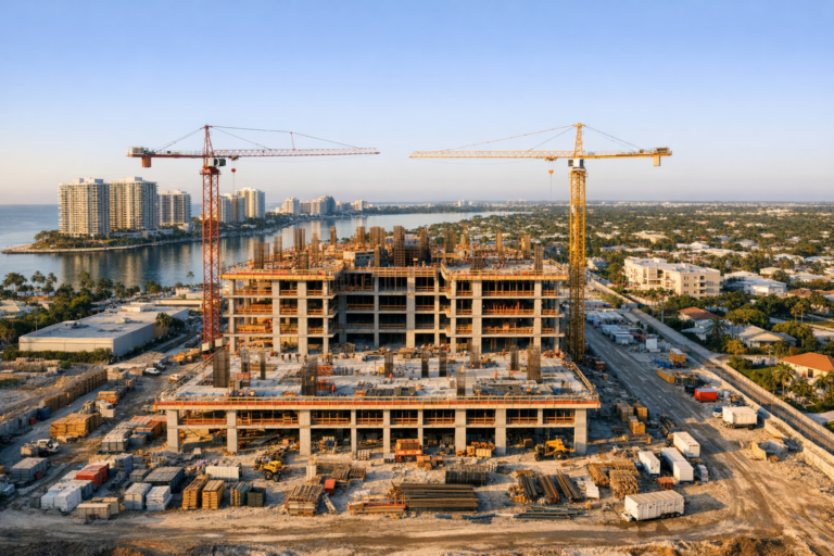
Developers can use aerial photography to show a site’s relationship to surrounding infrastructure and nearby growth. As construction progresses, recurring aerial imagery can document both the project and the broader area, helping stakeholders understand how the development fits into its environment.
Hotels, Venues, and Event Properties
For hospitality and event locations, aerial imagery can show more than the property boundary. It can highlight nearby beaches, marinas, downtown areas, parking, outdoor spaces, or scenic surroundings that influence guest experience and booking decisions.
Retail Centers and Mixed-Use Properties
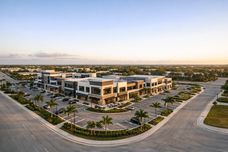
Retail and mixed-use properties benefit from visuals that show parking access, anchor tenants, nearby neighborhoods, intersections, and complementary businesses. Aerial images can help tenants and investors understand the surrounding commercial ecosystem.
Professional Drone Operations and Compliance Matter
Commercial drone photography is not only about creative visuals. It also requires safe, responsible, and compliant operations. In the United States, commercial drone pilots must operate under FAA Part 107 rules, which include requirements related to pilot certification, airspace, altitude, aircraft operation, and safety practices.
This is especially important in South Florida, where airports, controlled airspace, busy coastal areas, dense urban zones, and event activity can affect flight planning. A professional drone company should assess the location before the shoot, confirm any airspace considerations, plan safe takeoff and landing areas, monitor weather, and operate with awareness of people, property, and surroundings.
For clients, hiring an FAA Part 107 certified drone operator helps reduce risk and ensures the work is handled with the professionalism expected for commercial marketing assets.
How to Prepare for an Amenity-Focused Drone Shoot
Property owners, brokers, and marketing teams can improve the outcome of a drone shoot by preparing a few details in advance. The more clearly the goals are defined, the more targeted the final image set will be.
- Create a short list of the most important nearby amenities to capture.
- Share any required angles for brochures, websites, proposals, or presentations.
- Identify property boundaries, parking areas, entrances, and access points.
- Schedule around landscaping, exterior maintenance, or construction activity when possible.
- Consider timing based on sun direction, traffic patterns, and property appearance.
- Clarify whether still photography, video, or both are needed.
A professional drone team can then translate those priorities into a practical shot plan while adjusting for weather, light, airspace, and safety conditions.
FAQ
What is aerial property photography?
Aerial property photography uses drone imagery to capture real estate from an elevated perspective. For commercial properties, it is often used to show the building, site layout, access points, parking, surrounding roads, and nearby amenities.
How does drone photography help highlight amenities?
Drone photography can show the property and nearby features in the same frame. This helps viewers understand proximity to restaurants, shopping, transportation, water, parks, entertainment, and other location advantages without relying only on written descriptions.
Is aerial photography useful for commercial real estate listings?
Yes. It is especially useful when location, access, visibility, or surroundings are part of the property’s value. Aerial images can help brokers, owners, and marketing teams present a more complete view of the opportunity.
Can drone photos replace ground-level real estate photos?
Usually, they work best together. Ground-level photos show architectural details, entrances, interiors, and human-scale features. Aerial photos show context, layout, access, and proximity. A complete marketing package often includes both.
Do commercial drone photographers need FAA certification?
For commercial drone work in the United States, the operator must comply with FAA Part 107 requirements. Working with a certified professional is important for safety, compliance, and project reliability.
Bringing Location Value Into Clear View
The right aerial imagery does more than make a property look impressive. It helps buyers, tenants, investors, and stakeholders understand why the location matters. By showing nearby amenities, access, neighborhood character, and surrounding development, aerial property photography turns location details into clear visual evidence.
For South Florida commercial properties, that context can be a major advantage. Whether the goal is to market a listing, lease space, promote a development, document progress, or showcase a venue, professionally planned drone photography can help present the property with clarity and confidence.
Skyview Motions provides FAA Part 107 certified commercial drone photography and videography for real estate, construction, events, and business marketing throughout South Florida. If your property’s surroundings are part of its value, a strategic aerial shoot can help bring that value into focus.