A commercial property does not become marketable on the day the listing goes live. Its story begins much earlier, when the site is cleared, foundations are poured, structures rise, and exterior details start taking shape. For developers, contractors, property managers, brokers, and marketing teams, photography is not just a final deliverable. It is a visual record of progress, planning, investment, and value.
That is why construction and real estate photography work best when they are treated as part of one continuous visual strategy. The same project may need clear documentation for stakeholders during construction, polished aerial visuals for leasing or sales, and updated marketing assets after completion. When each stage is photographed with purpose, the final result is more useful, more consistent, and more valuable.
In South Florida, where commercial development, high-visibility properties, and competitive real estate markets move quickly, professional drone photography helps decision-makers see the full picture. It provides context from above, captures scale, improves communication, and helps completed properties stand out in a crowded market.
Why Photographing Every Stage Matters
Many teams wait until a project is finished before scheduling professional photography. While final marketing images are important, waiting until the end misses several opportunities. Construction progress imagery can support project management, investor updates, owner reporting, pre-leasing campaigns, insurance documentation, and long-term asset records.
Each stage serves a different purpose. Early site photos show access, surrounding conditions, drainage patterns, staging areas, and neighboring properties. Mid-construction photos document work completed, changes in site organization, installed structures, and the relationship between buildings, roads, parking, and utilities. Completion photography shifts the focus to presentation, curb appeal, amenities, access, and marketability.
When images are captured consistently over time, they become more than attractive visuals. They become a timeline. This can be especially useful for general contractors, developers, architects, engineers, and owners who need to communicate progress without requiring every stakeholder to visit the site in person.
The Construction Phase: Documenting Progress With Purpose
Construction photography should be clear, repeatable, and practical. The goal is not simply to create dramatic aerial views. The goal is to capture the information that matters to the people managing and financing the project.
Site Preparation and Early Development
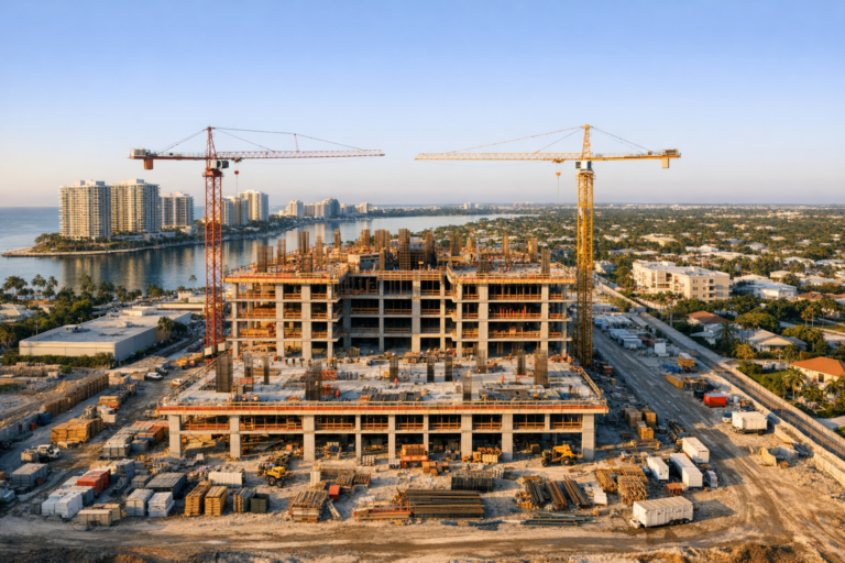
Before vertical construction begins, aerial photography can document existing conditions, cleared areas, material staging, equipment placement, access points, perimeter conditions, and nearby roads or properties. These early images create a visual baseline that can be compared against future progress.
For larger commercial sites, this stage is especially important because ground-level photos often cannot show the full layout. A drone perspective can reveal how the site connects to surrounding infrastructure, where crews are operating, and how the footprint is taking shape.
Foundation, Framing, and Structural Progress
As the project advances, aerial images help stakeholders understand progress in a way that charts and written reports cannot always communicate. A series of consistent overhead and angled views can show the evolution of slabs, roofs, exterior walls, parking areas, landscaping, and site circulation.
For contractors, these images may support owner updates and internal coordination. For developers, they can help communicate momentum to investors, lenders, tenants, or future buyers. For marketing teams, they can provide early visual assets for announcements, project pages, or pre-leasing materials.
Consistency Is What Makes Progress Photos Valuable
The most useful construction progress photography is planned. Repeating similar angles, elevations, and general compositions over time makes comparison easier. If one month shows a wide northwest view and the next month only shows tight detail shots from the opposite side, the images may look good individually but be less helpful as documentation.
A professional drone photographer should understand how to build a repeatable visual sequence. This may include wide establishing views, straight-down overheads, oblique angle shots, key access points, street frontage, roofline progress, and amenity areas. The exact shot list depends on the site and project goals.
Transitioning From Documentation to Marketing
As construction nears completion, the photography strategy should evolve. The focus shifts from documenting work in progress to presenting the property as an asset. This transition is where many projects lose visual continuity. Construction photos may stop too early, and marketing photos may start too late.
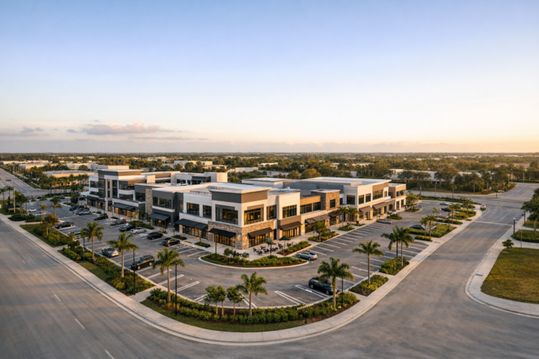
Capturing the property during the final stages can be useful for showing near-completion momentum, especially for commercial real estate teams preparing listings, lease-up campaigns, investor updates, or grand opening promotions. A clean aerial image of a nearly finished building, paved parking, installed landscaping, and visible signage areas can help generate interest before the property is fully occupied.
However, timing matters. If a property is still surrounded by heavy equipment, debris, temporary fencing, or unfinished landscaping, the images may not be ideal for public marketing. A professional approach separates internal progress documentation from outward-facing real estate photography.
The Real Estate Listing Phase: Showing Value, Location, and Context
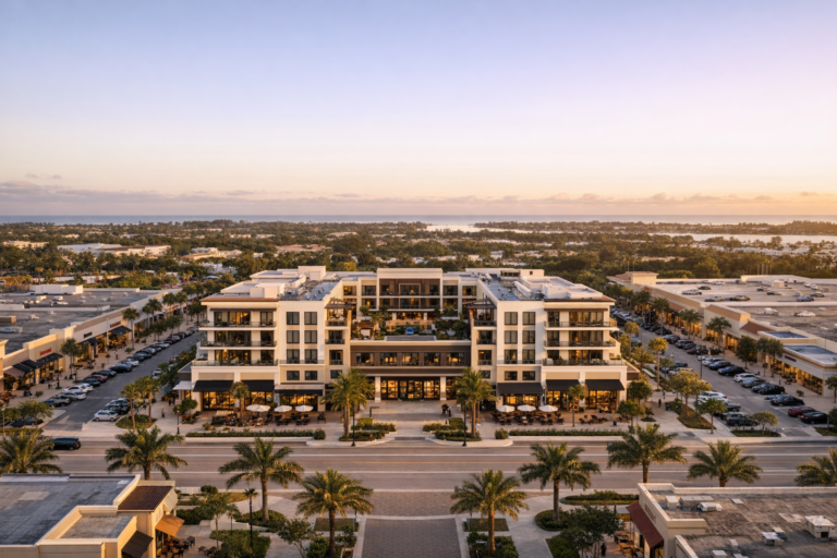
Commercial real estate photography is about helping a buyer, tenant, investor, or decision-maker understand the property quickly. Drone imagery is especially effective because it shows scale and context that ground-level photography cannot fully capture.
For a commercial listing, the viewer often wants to know more than what the building looks like. They want to understand access, visibility, frontage, parking, neighboring businesses, traffic corridors, nearby rooftops, waterfront proximity, and overall site positioning. Aerial photography can answer many of those questions in seconds.
What Aerial Real Estate Photography Should Capture
A strong commercial real estate aerial set may include the building exterior, parking layout, ingress and egress points, surrounding roads, adjacent parcels, nearby commercial activity, landscaping, signage opportunities, roof condition from a visual standpoint, and the overall relationship between the property and its market area.
In South Florida, location often plays a major role in perceived value. Proximity to major roads, business districts, residential communities, marinas, beaches, airports, or redevelopment areas can be highly relevant depending on the property type. Drone photography helps communicate that context visually without overwhelming the viewer with explanation.
Ground Photography Still Matters
Drone photography is powerful, but it should not replace ground-level commercial photography when a listing needs a complete visual package. Ground images can highlight entrances, lobbies, storefronts, amenities, interiors, finishes, loading areas, and pedestrian-level curb appeal. The strongest marketing packages often combine aerial and ground photography so the viewer understands both the big picture and the property details.
Planning a Photography Timeline From Start to Finish
The best results come from planning photography before the first set of images is needed. A practical timeline can help reduce rushed scheduling, inconsistent angles, and missed milestones.
For construction, many teams choose monthly or milestone-based photography. Monthly photography works well for longer projects because it creates a predictable record. Milestone photography may be better for smaller projects or specific deliverables, such as site clearing, foundation completion, topping out, exterior completion, paving, landscaping, and final completion.
For real estate marketing, scheduling should account for site readiness. If the goal is to create listing images, the property should be as clean and complete as possible. Parking lots should be cleared when feasible, landscaping should be installed, exterior surfaces should be clean, and any temporary construction material should be removed from key views. Small details can make a significant difference in how professional the final images feel.
What Professional Drone Photography Adds
Commercial drone photography is not only about flying a camera. It requires planning, airspace awareness, safety judgment, composition, lighting, and an understanding of how business clients use the final images.
An FAA Part 107 certified drone operator understands the operating rules that apply to commercial drone work in the United States. Professional operators also evaluate site conditions, nearby people and vehicles, obstacles, weather, airport-related considerations, and safe takeoff and landing areas before flying.
For business clients, this matters because drone operations often take place around active job sites, commercial properties, roads, parking lots, and public-facing environments. Safety and professionalism should never be treated as extras. They are part of the service.
How to Get More Value From Each Photo Session
Before scheduling a shoot, define how the images will be used. Construction teams may need documentation for reports, presentations, and archives. Brokers may need listing images, email marketing visuals, and social media assets. Developers may need investor updates and website imagery. Event teams may need aerial coverage that captures attendance, layout, and atmosphere.
A clear use case helps determine the right angles, time of day, file orientation, and level of detail. For example, a leasing team may need wide aerial views that show nearby roads and parking. A construction manager may need more consistent overhead documentation. A property manager may want updated visuals after renovations, repainting, landscaping, or tenant improvements.
It is also helpful to identify must-capture areas before the shoot. These may include the primary entrance, access roads, parking fields, loading zones, amenities, storefronts, roof areas, waterfront edges, or neighboring landmarks. A thoughtful shot list improves efficiency and helps ensure the final gallery supports the business objective.
Common Mistakes to Avoid
One common mistake is treating all drone photos the same. A beautiful aerial image may not be helpful if it does not show the information stakeholders need. Construction documentation and real estate marketing require different visual priorities.
Another mistake is waiting for perfect conditions but missing key milestones. Weather, site access, and construction schedules can change quickly. While lighting and cleanliness matter, progress documentation should follow the project timeline closely enough to preserve an accurate record.
Finally, avoid using unlicensed or inexperienced operators for commercial needs. Poor composition, unsafe operations, inconsistent image quality, or lack of understanding of commercial use cases can reduce the value of the final deliverables. For business-critical imagery, experience matters.
FAQ
How often should a construction site be photographed?
It depends on the project length, reporting requirements, and pace of work. Monthly photography is common for ongoing progress documentation, while milestone-based sessions may be appropriate for shorter projects or key construction phases.
When is the best time to photograph a completed commercial property?
The best time is usually after exterior improvements, paving, landscaping, cleaning, and visible punch-list items are complete. Early morning or late afternoon light often creates a more polished look, depending on the property orientation and weather.
Can the same drone photos be used for construction updates and real estate listings?
Sometimes, but not always. Progress photos are primarily informational, while listing photos should be composed and timed for presentation. A strong visual plan captures both types of images at the right stages.
Do commercial drone photographers need FAA certification?
In the United States, drone pilots conducting commercial operations must hold a Remote Pilot Certificate under FAA Part 107. Hiring a certified operator helps support safe, compliant commercial drone operations.
What should we prepare before a drone photography session?
Confirm site access, identify key areas to capture, communicate any safety restrictions, remove unnecessary clutter when possible, and share how the images will be used. Clear preparation leads to better results.
Bringing the Full Property Story Into Focus
From early site work to final listing photography, each stage of a commercial property has visual value. Construction images help teams document progress, communicate clearly, and maintain a reliable project record. Real estate images help present the finished asset with context, professionalism, and market appeal.
When both phases are planned together, the result is a stronger visual story and a more useful image library. Instead of disconnected photos captured only when someone remembers to schedule them, the project gains a consistent record from construction through completion.
Skyview Motions provides professional commercial drone photography and videography for construction, commercial real estate, events, and business properties throughout South Florida. If your team needs clear progress documentation or polished aerial marketing visuals, a planned approach can help you capture every important stage with confidence.