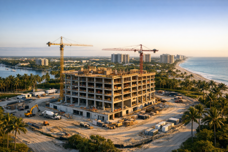
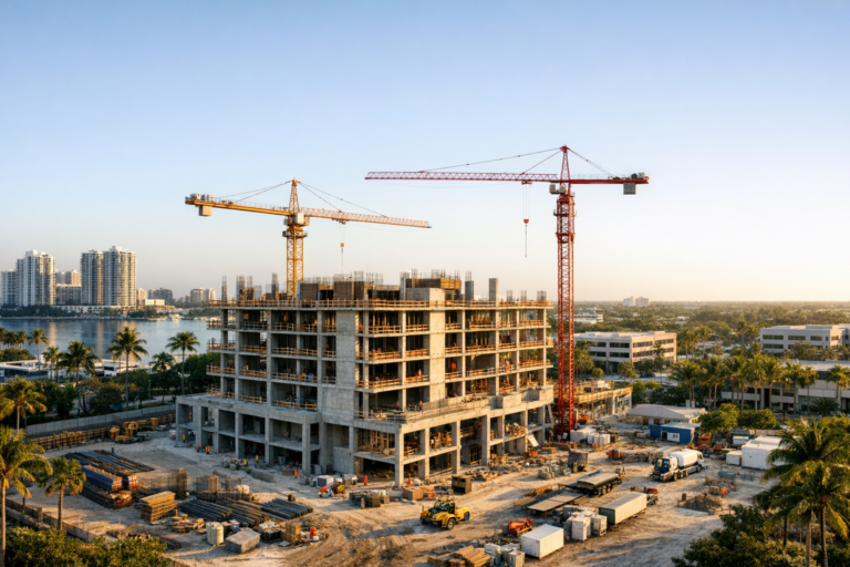
Large construction sites rarely move forward in one neat, easy-to-monitor area. A developer may need to understand what is happening at the building pad, parking structure, utility trench, material staging zone, access road, and perimeter improvements all in the same week. Ground-level photos help, but they often show only one narrow viewpoint at a time. That can make it difficult to see how separate areas of the jobsite are progressing in relation to one another.
Drone construction monitoring gives developers a clearer way to view the entire site, compare work zones, and document progress from consistent aerial perspectives. When planned correctly, drone photography can help project stakeholders see patterns, identify gaps, communicate more effectively, and maintain a reliable visual record throughout the construction timeline.
For developers managing complex commercial, multifamily, industrial, hospitality, or mixed-use projects in South Florida, aerial documentation is not just about attractive photos. It is about visibility, accountability, and better project awareness across every active area of the jobsite.
Why Multiple Jobsite Areas Are Difficult to Monitor From the Ground
Construction managers and field teams are on site every day, but developers and owners are often managing decisions from a broader perspective. They may be balancing financing, leasing, tenant coordination, design updates, municipal requirements, schedule pressure, and communication with investors or partners. A few ground photos from different team members can be helpful, but they do not always provide the full picture.
Ground-level documentation has natural limitations. It can be affected by blocked sightlines, equipment, temporary fencing, weather conditions, staging changes, and site access restrictions. A photo taken from one corner of a project may show activity in that immediate area, but it may not reveal how grading, utilities, vertical construction, roofing, landscaping, or paving are progressing across the rest of the site.
On a multi-acre project, the challenge becomes even greater. One area may appear ahead of schedule while another is delayed. Materials may be delivered to one location but needed elsewhere. Access routes may shift as phases change. Without a consistent wide-area view, it can be hard for decision-makers to understand how all of these moving parts connect.
How Drone Photography Creates a Complete Jobsite View
Professional drone photography provides a visual overview that is difficult to achieve from the ground. From an elevated perspective, a drone can capture the relationship between multiple work zones in a single image or short sequence. This allows teams to see not only what is happening, but where it is happening and how each area relates to the overall site plan.
For developers, this is especially useful when monitoring phased construction. Drone images can show the progress of site clearing, earthwork, drainage improvements, building foundations, structural components, exterior envelope work, parking areas, roadways, and common areas. When captured consistently over time, these images become a visual timeline of the project.
The greatest value often comes from repeatability. When aerial photos are taken from similar angles, elevations, and locations during each visit, progress becomes easier to compare. Stakeholders can review what changed since the last flight instead of trying to interpret random photos taken from different locations.
Key Areas Developers Can Monitor With Drone Imagery
Every project is different, but most active jobsites have multiple areas that benefit from aerial documentation. A structured drone construction monitoring approach helps ensure these areas are captured consistently.
Sitework, grading, and earth movement
Early project stages can look chaotic from the ground. Drone photography helps document clearing, rough grading, fill placement, retention areas, drainage features, and site elevation changes. For developers, this provides a broad understanding of how the raw site is being shaped before vertical construction begins.
Foundations and building pads
Aerial images can help show foundation layout, slab preparation, formwork, and the relationship between individual building pads. This is valuable on projects with multiple buildings, tenant spaces, or future expansion areas because it captures overall site organization from above.
Vertical construction progress
Once structures begin to rise, drone photography can document framing, concrete work, steel erection, roofing, exterior finishes, and building envelope progress. From the air, developers can quickly compare progress among buildings or sections of the same structure.
Parking, access roads, and circulation
Vehicular circulation is often one of the most important parts of a commercial development. Drone imagery can show roadway installation, parking lot layout, curbing, striping progress, loading areas, and site access points. This broader perspective is useful for understanding how the property will function once complete.
Material staging and equipment locations
On large jobsites, staging areas can shift frequently. Aerial documentation helps show where materials, equipment, trailers, and laydown areas are located. This can support coordination discussions when space is tight or when multiple trades are active at the same time.
Perimeter conditions and neighboring context
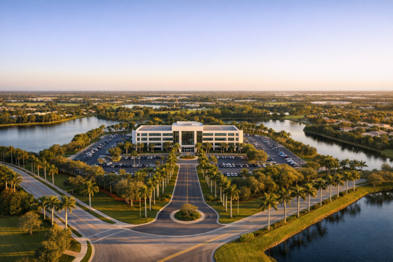
Developers often need to understand how construction activity relates to surrounding roads, adjacent properties, drainage areas, public access points, or nearby businesses. Drone photography can capture these contextual details while maintaining a clear view of the project as a whole.
How Consistent Drone Monitoring Improves Communication
Clear communication is one of the biggest benefits of ongoing aerial documentation. A single drone image can often explain what would take several paragraphs to describe. This becomes especially useful when project stakeholders are not all able to visit the site in person.
Developers can use drone photos and videos during internal updates, owner meetings, lender reviews, investor communications, marketing coordination, and discussions with design or construction teams. The imagery gives everyone a shared visual reference, reducing confusion and helping conversations stay focused on the actual site conditions.
For example, if one building section is ready for roofing while another is still in framing, an aerial progress image can show that difference clearly. If paving is delayed because underground utility work is still active in a specific zone, a wide aerial view can help stakeholders understand why that area is affecting the broader schedule. This type of clarity supports better decision-making without assigning blame or relying on incomplete updates.
Using Drone Photography to Compare Progress Over Time
The real power of drone construction monitoring becomes clear when imagery is captured on a regular schedule. Weekly, biweekly, or monthly flights can create a visual timeline that shows how the project has changed from one milestone to the next.
This historical record can be useful for many reasons. It can help developers verify visible progress, understand sequencing, explain delays, document completed work, support marketing efforts, and preserve a record of important project stages. It can also be helpful months later when someone needs to review how a portion of the site evolved over time.
Consistency matters. Random photos are better than no photos, but a planned flight path and shot list produce more reliable documentation. The most useful programs often include repeated overview photos, key angle photos, targeted zone photos, and short video clips that show movement across the site.
What Professional Drone Monitoring Should Include
Not all aerial photography is equally useful for construction documentation. A strong monitoring program should be planned around the project layout, stakeholder needs, safety requirements, and reporting goals.
A defined shot list
Before each flight, it helps to identify the areas that need to be captured. This may include specific buildings, elevations, infrastructure areas, staging zones, access roads, or site entrances. A defined shot list makes the imagery more complete and reduces the chance of missing important work areas.
Repeatable perspectives
Repeatable aerial angles make progress easier to evaluate. When the same general views are captured each time, developers can compare images from different dates and immediately recognize changes.
High-resolution photo and video deliverables
Professional-quality imagery should be clear enough for presentations, project records, marketing use, and internal review. Depending on the project, both still photography and video may be useful. Photos are often best for documentation, while video helps communicate the scale and flow of a jobsite.
Safe and compliant operations
Commercial drone work should be conducted by an FAA Part 107 certified remote pilot. Professional operators also consider airspace requirements, weather, site hazards, nearby people, property boundaries, and coordination with the project team. Safety and compliance are essential on active jobsites where cranes, equipment, workers, and changing conditions are present.
Practical Tips for Developers Planning Drone Site Monitoring
Developers can get more value from aerial documentation by approaching it as a planned service rather than a one-time photo shoot. A few practical steps can make the final deliverables more useful.
First, decide how often the site should be documented. Fast-moving projects may benefit from weekly or biweekly flights, while slower phases may only need monthly updates. The right schedule depends on project pace, stakeholder expectations, and how often meaningful visual changes occur.
Second, identify the priority areas. A developer may want broad overview images, but also close attention to specific buildings, tenant spaces, infrastructure areas, or public-facing improvements. Communicating these priorities helps the drone team capture what matters most.
Third, coordinate with the general contractor or site superintendent. Drone flights should be planned around safety, access, active work areas, crane operations, and any site-specific restrictions. Good coordination helps the flight run smoothly and minimizes disruption.
Fourth, organize imagery by date. Aerial photos become more valuable when they are easy to find later. Consistent file organization and clear delivery timelines make the documentation useful beyond the day it is captured.
Where Drone Monitoring Fits Alongside Other Project Tools
Drone photography does not replace project management software, site inspections, survey work, engineering review, or contractor reporting. Instead, it complements those tools by adding clear visual context.
Aerial imagery can help non-technical stakeholders understand what is happening without needing to interpret drawings or construction schedules. It can also help technical teams discuss site logistics, phasing, and visible progress using a common visual reference. The strongest results come when drone documentation supports, rather than substitutes for, the established construction management process.
It is also important to understand the limits of standard drone photography. Aerial images can show visible conditions, progress, access, and layout, but they are not a replacement for certified inspections, surveying, engineering analysis, or code compliance reviews. A professional drone provider should be clear about what the imagery can and cannot confirm.
Why Local Experience Matters in South Florida
South Florida construction projects come with unique operating considerations. Weather can change quickly, coastal winds may affect flight planning, dense commercial areas may require additional awareness, and some locations may be near controlled airspace. A local drone team familiar with the region can plan more effectively and communicate realistic expectations.
For developers, hiring a professional commercial drone company is about more than getting attractive aerial photos. It is about working with a team that understands active jobsites, knows how to coordinate safely, and can produce imagery that is useful for documentation, communication, and decision-making.
Skyview Motions provides FAA Part 107 certified commercial drone photography and videography for construction projects throughout South Florida. Our approach is built around clear visuals, safe operations, and practical deliverables that help developers and project teams stay informed.
Frequently Asked Questions
How often should a developer schedule drone construction monitoring?
The best schedule depends on the pace and complexity of the project. Weekly or biweekly flights are often useful during active phases with frequent visible changes. Monthly flights may be enough for slower-moving phases or general recordkeeping.
Can drone photography help monitor several buildings on one site?
Yes. Drone imagery is especially useful for multi-building developments because it can capture each structure in relation to the rest of the site. This helps developers compare progress across buildings, phases, parking areas, and shared infrastructure.
Is drone monitoring useful if the general contractor already sends progress photos?
Yes. Contractor photos are valuable, but they are usually taken from the ground and may focus on specific details. Drone photography adds a wider perspective that shows how multiple areas of the site are progressing together.
Can drone photos be used for investor or lender updates?
In many cases, yes. High-quality aerial images can help communicate visible progress clearly to stakeholders who are not visiting the site regularly. Developers should still use appropriate financial, contractual, and project reporting documents alongside the imagery.
Does commercial drone work require FAA certification?
Yes. In the United States, commercial drone operations generally require the remote pilot to hold an FAA Part 107 certification. Developers should confirm that any drone provider they hire is properly certified for commercial work.
Conclusion
Monitoring multiple areas of a jobsite is one of the biggest challenges developers face during construction. Ground updates, meetings, and reports are important, but they do not always provide the full visual context needed to understand progress across an entire property.
Drone construction monitoring gives developers a clearer, more efficient way to see how different work zones are advancing, how site logistics are changing, and how the project is taking shape over time. With consistent aerial photography and videography, teams can communicate better, document key milestones, and make more informed decisions.
If your South Florida project would benefit from professional aerial construction documentation, Skyview Motions can help you plan a safe, reliable, and useful drone monitoring program tailored to your jobsite and reporting needs.