For developers, a construction project is never just what happens on the jobsite today. It is a sequence of decisions, approvals, conditions, milestones, changes, and handoffs that unfold over months or years. When that process is only documented through written reports, phone calls, and scattered progress photos, important context can be lost.
A consistent visual record from groundbreaking to completion gives developers a clearer way to understand what happened, when it happened, and how the project evolved. It supports communication, accountability, marketing, financing updates, investor reporting, and long-term asset records. Most importantly, it creates an organized visual history that can be reviewed long after crews, equipment, and temporary conditions have left the site.
Professional drone photography and videography have become especially valuable for this purpose because they capture the full scale of a project in a way ground-level images cannot. For commercial developments, multifamily projects, industrial sites, retail centers, and mixed-use properties, aerial documentation provides perspective, continuity, and clarity throughout the entire build.
What Construction Project Documentation Really Means
Construction project documentation is the organized record of a project from planning and mobilization through completion. It can include drawings, schedules, daily reports, permits, inspection notes, change orders, meeting minutes, site photos, videos, and closeout materials. Visual documentation is one of the most useful parts of that record because it shows real conditions, not just written descriptions.
For developers, visual documentation helps answer practical questions: Was the site cleared on schedule? When did vertical construction begin? What did the property look like before underground work was covered? How did access, staging, and neighboring conditions change over time? Were specific milestones completed before a draw request, stakeholder update, or leasing campaign?
The strongest documentation programs are not random collections of photos. They are consistent, repeatable, date-based visual records captured from planned viewpoints. Drone imagery strengthens this process by showing sitewide progress, surrounding infrastructure, logistics, roof conditions, parking areas, elevation changes, and the relationship between the development and its surrounding environment.
Why Developers Benefit From a Visual Record From Day One
Many project teams begin capturing visuals once construction is well underway, but developers gain the most value when documentation starts at or before groundbreaking. Early images establish a baseline condition of the property. They show existing site features, adjacent roads, drainage areas, neighboring structures, vegetation, access points, and pre-construction surroundings.
That baseline matters because construction changes a site quickly. Once fencing, demolition, clearing, grading, excavation, utilities, and foundation work begin, it may be difficult to reconstruct what existed beforehand. Aerial and ground-level visuals taken early can provide helpful context if questions arise later about site conditions, access, erosion control, staging, nearby properties, or the sequence of work.
From a business standpoint, early documentation also gives developers useful material for investor communications, public updates, municipal presentations, lender packages, and marketing timelines. The beginning of a project often carries strong storytelling value, especially when it can be compared with future phases and the final completed asset.
The Gaps That Written Reports Cannot Fill
Written construction reports are essential, but they have limits. A report may state that grading is complete, utilities are underway, or framing has started. A photo or video shows the scope, location, surrounding conditions, and visible progress at that moment in time. Visuals help people who are not on site understand the project without needing to interpret technical notes alone.
This is especially important for developers managing several projects, out-of-town investors, ownership groups, lenders, attorneys, consultants, leasing teams, or public stakeholders. Not everyone can visit the site regularly. A clear aerial update can communicate site progress in seconds and reduce confusion that often comes from fragmented updates.
Visual records can also reveal context that is easy to overlook in written documentation. Examples include material staging locations, site congestion, access constraints, temporary drainage conditions, parking impacts, nearby roadway activity, completed roof areas, façade progress, and the relationship between multiple buildings on a larger development.
How Drone Documentation Supports Each Phase of Development
Pre-Construction and Groundbreaking
Before major work begins, drone imagery can capture the existing property and surrounding area from multiple elevations and angles. These visuals are useful for baseline records, stakeholder presentations, community updates, and project launch marketing. Groundbreaking coverage can also document ceremonies, site preparation, and the beginning of mobilization.
Sitework, Utilities, and Foundations
Early construction phases often involve work that becomes hidden later. Excavation, underground utilities, grading patterns, drainage improvements, slabs, and foundation work may not be visible once construction advances. While drone imagery does not replace formal inspections or as-built documentation, it can provide a helpful visual timeline of site progress and major visible conditions before they are covered or changed.
Vertical Construction
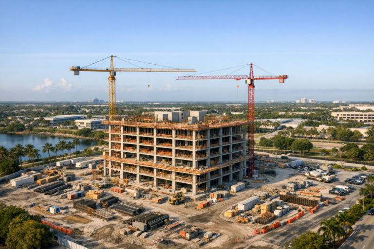
As the structure rises, regular drone updates help developers monitor the pace and sequence of construction. Aerial images can show building massing, floor progression, roof installation, façade work, site logistics, equipment placement, and the overall development footprint. For large sites, this perspective is often more informative than individual ground photos taken from limited angles.
Exterior Completion and Site Finishes
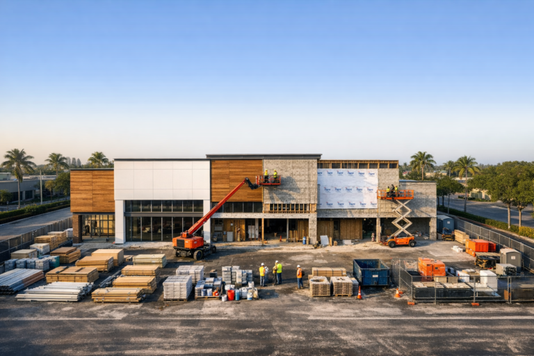
During later phases, drone documentation can capture paving, landscaping, amenity areas, exterior finishes, signage areas, parking lots, access roads, stormwater features, and rooftop conditions. These images are valuable for ownership updates, leasing materials, closeout records, and final comparisons against earlier project stages.
Final Completion and Asset Marketing
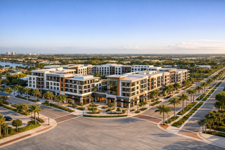
At completion, professional drone photography and videography transition from progress documentation into asset presentation. Developers can use final visuals for portfolios, broker packages, websites, investor reports, public relations, and future project proposals. When the completed images are paired with earlier milestones, they also tell a compelling before-and-after story.
Why Consistency Matters More Than Occasional Photos
The value of construction visuals increases when they are captured consistently. A single drone flight can be useful, but a planned schedule creates a true project timeline. Monthly, biweekly, or milestone-based documentation allows developers and project teams to compare the same site from the same perspectives over time.
Consistency helps identify changes, communicate progress, and maintain an orderly record. When photos are taken from similar altitudes, directions, and framing, the viewer can quickly understand what has changed between updates. This is much more effective than a folder of unrelated images taken from random locations by different people.
For developers, a practical documentation plan may include recurring aerial still photography, short progress videos, key milestone flights, oblique views of each elevation, top-down site overviews, and selected ground-level images. The right mix depends on the project size, schedule, stakeholder needs, and intended use of the content.
How Visual Documentation Helps Reduce Risk and Confusion
Construction projects involve many parties, and misunderstandings can be expensive. Visual documentation does not eliminate disputes or replace contracts, inspections, schedules, or professional reports. However, it can help clarify what was visibly present at a particular time.
If there is a question about site access, material placement, weather-related conditions, staging, completed exterior work, or visible progress at a milestone, dated visual records can provide useful context. They can also help developers communicate more clearly with general contractors, consultants, lenders, insurance representatives, and property stakeholders.
The goal is not to create surveillance. The goal is to maintain a reliable record. When everyone can refer to the same visual timeline, conversations tend to become more specific and productive.
What Developers Should Include in a Documentation Plan
A strong visual documentation plan should be created before the first flight whenever possible. Developers should consider the project timeline, key milestones, stakeholder reporting needs, site access, safety requirements, and final use of the imagery.
Important planning questions include:
- How often should the site be photographed or filmed?
- Which milestones must be documented?
- Who will use the images and videos?
- Are visuals needed for lenders, investors, leasing, marketing, or internal records?
- Which views should be repeated during each visit?
- Are there airspace, property access, or jobsite safety considerations?
- How should files be organized and delivered?
For many commercial projects, the most useful approach combines wide aerial overviews, angled views from multiple directions, close-range exterior progress images where appropriate, and short edited videos for stakeholder updates. Developers should also decide how files will be named, dated, stored, and shared so the archive remains useful throughout the project.
Drone Safety, FAA Compliance, and Professional Standards
Commercial drone operations require more than a good camera. In the United States, commercial drone pilots must operate under applicable FAA requirements, including Part 107 certification for most commercial drone work. Professional operators should understand airspace, weather, site hazards, equipment limitations, privacy considerations, and coordination with active construction teams.
On construction sites, safety planning is especially important. Drone operations should be coordinated with the site team so flights do not interfere with cranes, workers, equipment, deliveries, or restricted areas. A professional drone provider should be prepared to discuss flight timing, takeoff and landing locations, communication with site contacts, and any airspace authorization requirements when applicable.
Developers should look for a drone partner that treats documentation as a professional service, not a casual photo shoot. That means reliable scheduling, consistent capture methods, organized delivery, appropriate insurance, FAA compliance, and an understanding of how construction teams actually use progress imagery.
Why South Florida Projects Have Unique Documentation Needs
South Florida development often involves dense urban sites, coastal conditions, active roadways, tight staging areas, fast-changing weather, and high visibility within surrounding communities. These conditions make consistent documentation especially valuable.
Aerial visuals can help show how a project fits into its environment, including vehicle access, neighboring properties, parking areas, waterfront or roadway proximity, and surrounding commercial corridors. For developers, this perspective is useful not only during construction but also when presenting the completed property to buyers, tenants, investors, or the public.
Because South Florida airspace can vary significantly by location, professional planning matters. Some sites may be near airports, controlled airspace, heliports, high-rise areas, or sensitive operating environments. Working with an FAA Part 107 certified commercial drone company helps ensure that documentation is approached with the proper level of planning and responsibility.
Choosing the Right Drone Partner for Project Documentation
When evaluating a drone company, developers should look beyond image quality alone. The provider should understand commercial construction timelines, stakeholder expectations, repeatable capture, and professional communication. Beautiful images are valuable, but consistent and usable documentation is the real priority.
Ask potential providers how they plan recurring shoots, how they maintain consistent viewpoints, how quickly files are delivered, what types of images and video are included, and how they handle site coordination. It is also worth asking whether they have experience with commercial real estate, construction progress photography, and construction progress videography.
Skyview Motions provides commercial drone photography and videography for developers, contractors, property professionals, and project teams throughout South Florida. Our approach is built around clear communication, safe flight planning, FAA Part 107 certified operations, and high-quality visuals that support practical business needs throughout the life of a project.
Frequently Asked Questions
How often should developers schedule drone documentation?
The right schedule depends on the project size, pace, and reporting requirements. Monthly documentation works well for many developments, while faster-moving or higher-visibility projects may benefit from biweekly updates or milestone-based flights tied to major phases such as sitework, foundation, vertical construction, topping out, exterior completion, and final delivery.
Does drone documentation replace inspections or official records?
No. Drone imagery should not be treated as a substitute for inspections, surveys, engineering reports, or contractual documentation. It is a visual record that supports communication, context, and historical reference alongside formal project records.
What types of visuals are most useful for developers?
Developers typically benefit from wide aerial site overviews, angled views from multiple sides, milestone photos, short progress videos, final marketing imagery, and before-and-after comparisons. The most useful deliverables are organized, dated, and captured consistently over time.
Can drone imagery be used for investor or lender updates?
Yes. Professional visual updates can help investors, lenders, and ownership groups understand visible progress without visiting the site. Developers often use aerial images and videos in progress reports, presentations, and project communications.
When should documentation begin?
Ideally, documentation should begin before major site activity or at groundbreaking. Early visuals establish baseline conditions and make the finished project timeline more complete and useful.
A Complete Visual Record Is a Long-Term Asset
From groundbreaking to completion, every construction project creates a story of progress, decisions, challenges, and transformation. Developers who document that story visually gain more than attractive images. They gain a practical record that supports communication, accountability, marketing, reporting, and long-term asset management.
Consistent construction project documentation helps teams see the full picture, not just isolated moments. It provides context for stakeholders, preserves important milestones, and creates a clear visual archive that remains valuable after the project is delivered.
If you are developing a commercial project in South Florida, Skyview Motions can help you plan and capture professional drone photography and videography from the first day on site through final completion. A well-organized visual record starts with a thoughtful plan, and the best time to create that plan is before the next major milestone arrives.