On a construction site, layout affects almost everything: how crews move, where materials are stored, how equipment enters, where safety risks develop, and whether progress stays aligned with the plan. Yet from ground level, even experienced project teams can miss the full picture. A superintendent may understand one work area clearly, while an owner or developer may struggle to visualize how all areas connect.
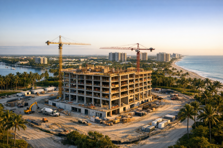
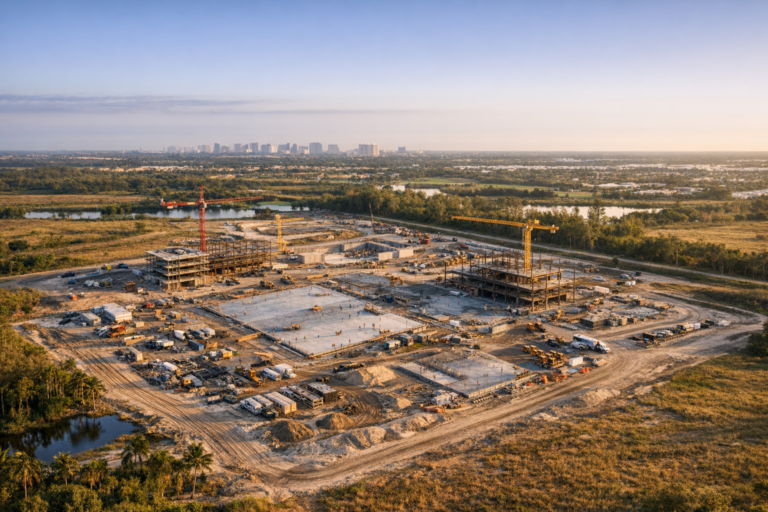
That is where construction site aerial photography becomes especially valuable. Aerial images provide an overhead view of the entire jobsite, making it easier for teams to understand spatial relationships, access points, staging areas, building placement, progress zones, and constraints that are difficult to see from the ground.
For developers, general contractors, construction managers, architects, engineers, and stakeholders, aerial photography is not just a visual upgrade. When captured consistently and professionally, it becomes a practical communication and documentation tool that supports better planning, clearer reporting, and more informed decision-making.
Why Site Layout Is Hard To Understand From Ground Level
Construction sites are dynamic environments. Temporary fencing, equipment, material deliveries, active trades, changing grades, and evolving building footprints can quickly make a site feel different from one week to the next. Ground photos may show useful detail, but they usually capture one direction at a time and often lack context.
For example, a ground-level image may show installed utilities, a crane location, or a framing area. However, it may not show how close that activity is to a laydown yard, vehicle entrance, drainage area, neighboring structure, or future phase of work. Without that context, teams may need additional explanations, multiple site walks, or marked-up drawings to understand the same condition.
Aerial photography helps bridge that gap. By showing the site from above, it allows teams to see the entire layout in one frame or a coordinated series of images. This makes it easier to interpret what is happening, where it is happening, and how it relates to the rest of the project.
How Aerial Photography Clarifies Construction Site Layout
A well-planned aerial image does more than look impressive. It organizes visual information in a way that helps people understand the site quickly. This is especially helpful when project stakeholders are not on site every day.
It Shows The Relationship Between Work Areas
Construction progress is often discussed by area, phase, elevation, floor, or scope. Aerial photography helps teams see how those areas relate to one another. For example, it can show whether sitework is keeping pace with building construction, whether parking areas are ready for the next stage, or whether access routes are being affected by new activity.
This broader perspective is useful during owner updates, internal project reviews, and coordination meetings. Instead of relying only on marked-up plans or verbal descriptions, teams can point to current aerial images and discuss the site as it actually exists.
It Makes Access And Circulation Easier To Evaluate
Site access can become a challenge as construction progresses. Entrances may shift, haul routes may narrow, and active work can affect deliveries, parking, and emergency access. Aerial photography gives project teams a clear view of how vehicles, equipment, and pedestrian pathways are organized.
For general contractors and construction managers, this can support more productive conversations about logistics. Are delivery trucks using the intended route? Is equipment staged in a way that limits movement? Is there enough clear space around active work zones? Aerial images do not replace formal logistics planning, but they help teams visually confirm how the plan is functioning in the field.
It Documents Staging, Laydown, And Material Storage
Material storage and staging areas can have a major impact on productivity. If materials are too far from the work area, crews lose time. If laydown areas are disorganized, safety and access can become concerns. If storage areas conflict with upcoming phases, work may need to be moved later.
Overhead imagery makes these conditions easier to evaluate. Teams can see whether materials are placed where planned, whether staging areas are expanding, and whether stored items are interfering with access, drainage, or upcoming work. This visual record is especially helpful when multiple subcontractors rely on limited space.
Practical Ways Teams Use Construction Aerial Images
The value of aerial photography increases when teams use it consistently. A single image can be helpful, but recurring aerial documentation creates a visual timeline that supports communication throughout the project.
Preconstruction And Existing Conditions
Before major work begins, aerial images can document existing site conditions, surrounding roads, neighboring properties, vegetation, utilities, access points, and drainage patterns visible from above. This gives the project team a reference point before mobilization.
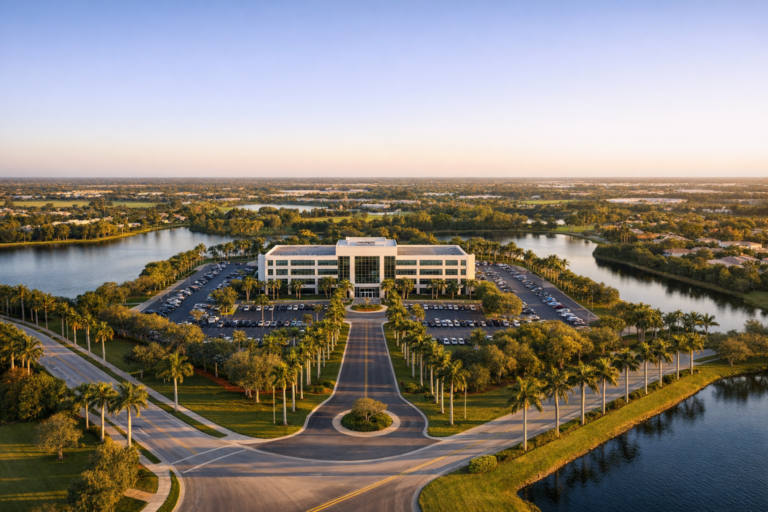
These images can also be useful for orientation. When stakeholders review plans, an aerial view of the actual property helps connect drawings with real-world conditions. This is particularly valuable on large sites, infill projects, waterfront properties, and locations with tight access or nearby active businesses.
Progress Meetings And Stakeholder Reports
Aerial photos are highly effective for progress communication. They help owners, investors, architects, consultants, and remote stakeholders understand what changed since the last update. Instead of reviewing isolated close-up photos, the team can see overall progress and then discuss specific work areas in more detail.
For many projects, aerial images become part of monthly or biweekly reporting. They can show site clearing, earthwork, foundations, vertical construction, roofing, paving, landscaping, and final completion from a consistent perspective. This makes progress easier to compare over time.
Coordination With Architects, Engineers, And Consultants
Design professionals and consultants often need clear visual context to evaluate field conditions. Aerial photography can help them understand how the constructed condition relates to surrounding site elements, utilities, grades, drainage features, parking areas, and neighboring structures.
While aerial photos are not a substitute for surveys, inspections, or engineered documentation, they can improve communication when teams are reviewing layout questions, access concerns, or visible site constraints. They provide a shared visual reference that can reduce confusion and support faster discussion.
Marketing, Leasing, And Public Communication
For developers and commercial real estate teams, aerial construction images also support marketing and stakeholder communication. They can help show project momentum, location context, proximity to roads or amenities, and the scale of development.
This is particularly useful for commercial properties, multifamily developments, retail centers, industrial sites, mixed-use projects, and hospitality construction. Professional aerial photography can help communicate progress without requiring every interested party to visit the site in person.
What Makes Construction Site Aerial Photography Effective
Not every drone image provides the same value. To help teams understand layout, aerial photography should be planned with purpose. The best results come from a consistent approach, safe operations, and an understanding of what construction teams actually need to see.
Consistent Flight Angles And Image Locations
Consistency is one of the most important factors in construction documentation. When images are captured from similar angles and positions over time, changes become easier to recognize. Teams can compare one week or month to the next without guessing whether differences are caused by progress or by a different camera angle.
Useful image sets often include straight-down overhead views, oblique views from each side of the site, and wider context shots showing surrounding roads or adjacent properties. The right mix depends on the site size, project type, and reporting needs.
Clear Visibility Of Key Site Features
Aerial photos should be composed to show important layout elements clearly. This may include entrances, internal haul routes, cranes, concrete pours, excavation areas, material storage, parking, temporary utilities, building pads, roof areas, and completed site improvements.
For South Florida projects, weather, sun angle, reflections, and afternoon storms can affect image quality. Planning flights around appropriate lighting and site activity helps produce images that are easier to interpret and more useful for documentation.
Professional Safety And Compliance
Commercial drone operations require careful attention to safety, airspace, people on site, equipment movement, and applicable FAA requirements. A professional drone operator should understand how to plan a flight that captures useful images while respecting operational limits and site safety protocols.
For construction environments, that means coordinating appropriately, avoiding unnecessary disruption, and maintaining a clear focus on safe flight operations. Skyview Motions provides FAA Part 107 certified commercial drone services for South Florida businesses, including construction progress photography and documentation.
Aerial Photography Compared With Ground Photos
Ground photography and aerial photography are not competing tools. They work best together. Ground images show detail: installation quality, materials, equipment, finishes, and close-up conditions. Aerial images show context: layout, access, progress, staging, and the relationship between work areas.
For example, a ground photo may show that a section of paving has been installed. An aerial photo can show how that paving connects to the building entrance, parking area, loading zone, and remaining sitework. A close-up photo may show structural steel in place. An aerial photo can show how that steel phase fits into the full building footprint.
When used together, both perspectives give teams a more complete understanding of the project.
Best Practices For Using Aerial Images In Construction Documentation
To get the most value from aerial photography, teams should think beyond individual images and establish a simple documentation process.
- Set a capture schedule. Weekly, biweekly, or monthly intervals help create a reliable visual timeline.
- Identify priority views. Decide which angles and areas matter most for progress reporting and layout review.
- Capture both overview and detail. Wide aerials show context, while closer views highlight specific phases or areas.
- Use images in meetings. Reviewing current aerial photos during coordination meetings helps keep everyone aligned.
- Store files consistently. Organize images by date, site, and project phase so they can be found later.
- Coordinate with the site team. Proper planning helps avoid conflicts with active operations and improves image quality.
These practices are simple, but they make aerial photography far more useful as the project progresses.
When Aerial Photography Is Especially Valuable
Almost any construction project can benefit from aerial documentation, but some situations make the overhead perspective particularly helpful.
Large sites benefit because it is difficult to understand the full layout from the ground. Tight urban or infill sites benefit because access, staging, and neighboring constraints are often critical. Fast-moving projects benefit because conditions change quickly and stakeholders need current visuals. Projects with remote owners or investors benefit because aerial images reduce the communication gap between the jobsite and decision-makers.
In South Florida, aerial photography is also valuable for projects where water, road access, surrounding development, parking, and landscape integration influence how the site is understood. A drone perspective can show the broader project environment more effectively than ground-level photos alone.
What To Look For In A Construction Drone Photography Provider
Choosing a drone provider for construction work is different from hiring someone for general photography. Construction sites require planning, consistency, safety awareness, and an understanding of what project teams need to document.
Look for a provider that is FAA Part 107 certified for commercial drone operations, understands construction environments, communicates clearly with site contacts, and can capture repeatable views over time. The provider should be able to deliver clean, organized images that support practical use, not just attractive visuals.
For developers, contractors, and project teams in South Florida, Skyview Motions offers professional drone photography and videography services designed to support construction progress documentation, real estate marketing, and commercial project communication.
FAQ
How often should a construction site be photographed from the air?
The right schedule depends on the pace and complexity of the project. Monthly aerial photography works well for many projects, while faster-moving jobs may benefit from weekly or biweekly captures. Major milestones, such as site clearing, foundation work, vertical construction, roofing, paving, and completion, are also good times to schedule aerial documentation.
Can aerial photos replace site plans or surveys?
No. Aerial photos are visual documentation tools. They can help teams understand layout and progress, but they do not replace official surveys, engineered drawings, inspections, or as-built documentation. They are most valuable when used alongside formal project documents.
What types of construction projects benefit most from aerial photography?
Commercial developments, multifamily projects, industrial sites, retail centers, hospitality properties, infrastructure-related work, and large site improvements can all benefit. Aerial photography is especially useful when teams need to communicate progress, access, staging, and overall layout to stakeholders who are not on site every day.
Is drone photography safe on an active construction site?
Drone photography can be conducted safely when planned by a qualified commercial operator who follows applicable FAA requirements and coordinates with the site team. Active construction sites require attention to people, equipment, airspace, weather, and site-specific safety procedures.
What should be included in a construction aerial photo set?
A useful set often includes overhead views, angled views from multiple directions, images of access points, staging areas, building progress, sitework, parking areas, and surrounding context. The exact shot list should match the project goals and the needs of the team reviewing the images.
Clearer Site Understanding Starts With A Better View
Construction teams make better decisions when they can see the full picture. Aerial photography helps turn a busy, complex jobsite into a clear visual reference that owners, contractors, consultants, and stakeholders can understand quickly.
By documenting layout, access, staging, progress, and surrounding context, professional drone imagery supports better communication and more confident project coordination. It helps teams see how individual work areas connect and how the site is evolving over time.
If your project team needs reliable aerial documentation for a construction site in South Florida, Skyview Motions can help capture clear, professional drone photography that supports planning, progress reporting, and stakeholder communication.