Construction projects can last months or years, and the value of progress photos increases dramatically when those images are captured in a consistent, repeatable way. A single impressive aerial photo may look good in a presentation, but long-term construction documentation depends on comparison. Owners, contractors, developers, architects, engineers, and lenders need to understand what changed, when it changed, and whether the work is moving as expected.
That is where consistent photo angles become important. When a site is photographed from the same vantage points over time, progress is easier to verify, communicate, and archive. The images stop being isolated snapshots and become a visual record of the project lifecycle.
For commercial drone work, consistency is not accidental. It requires planning, site awareness, disciplined flight execution, and a clear understanding of how construction teams use visual documentation. When done correctly, construction progress documentation becomes a practical project management tool rather than a folder full of disconnected images.
Why Consistent Photo Angles Matter
Construction sites change quickly. Foundations are poured, structural elements rise, exterior finishes are installed, site work evolves, and staging areas move. If each photo session is captured from different angles, different elevations, or different distances, comparing one date to another becomes difficult.
Consistent photo angles create a reliable visual baseline. When the camera position, direction, altitude, and framing remain similar from one visit to the next, stakeholders can quickly identify what has changed. This is especially useful for teams reviewing progress remotely or comparing completed work against a schedule of values, milestone plan, or internal construction timeline.
For example, a monthly aerial image of a multifamily development captured from the same southwest corner can show how framing, roofing, parking areas, landscaping, and access roads progressed over time. If the angle changes each month, the viewer may spend more time reorienting themselves than evaluating the work.
Photos Are Most Valuable When They Are Comparable
The purpose of progress photography is not simply to document that a site exists on a certain date. The purpose is to make change visible. Comparable imagery helps project teams answer practical questions, including:
- What work was completed since the last site visit?
- Are specific areas progressing in the expected sequence?
- Did site conditions change in a way that affects access, staging, or safety planning?
- Can remote stakeholders clearly understand the current status?
- Is there a visual record to support meetings, reports, payment applications, or dispute resolution?
Consistent angles reduce confusion because viewers are not forced to mentally reconstruct the site from a new perspective each time. The visual language stays the same, which makes the differences stand out.
How Inconsistent Angles Create Problems
Inconsistent photography may still be useful for marketing or general updates, but it weakens the value of long-term documentation. A drone image captured from 250 feet looking north may not compare well with a later image captured from 120 feet looking east. Both may be sharp, attractive photos, but they do not tell a clean before-and-after story.
This can create several problems for project teams. Progress may appear slower or faster than it actually is because the perspective changed. Important site areas may be missing from one update and visible in another. People reviewing the images may ask for clarification, which creates extra communication instead of reducing it.
In some cases, inconsistent angles can also limit the usefulness of the archive. Months later, when a contractor, owner, or consultant needs to look back at a specific phase, the images may not provide the continuity needed to understand sequencing. A well-organized visual record should become more valuable with time, not less.
What Makes a Photo Angle Repeatable?
Repeatability is more than pointing the drone in the same general direction. Professional construction progress documentation usually considers several variables that affect the final image.
Camera location and orientation
The drone should return to the same general location in relation to the site, such as each corner of the property, the main entrance, the staging area, or a defined building elevation. Orientation matters as well. A view looking directly across a structure will communicate differently than an angled view across the same structure.
Altitude and distance
Altitude changes the scale of the image. Higher views can show the full site context, surrounding roads, access points, and adjacent properties. Lower views can show structural detail, facade progress, or equipment placement. Both can be useful, but they should be repeated consistently when the goal is comparison.
Gimbal angle and framing
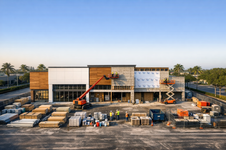
A straight-down image, often called a top-down or nadir view, provides a different type of documentation than an oblique image captured at an angle. Top-down images are helpful for layout, site logistics, and broad comparison. Oblique images are often better for communicating vertical progress, building massing, exterior finishes, and the experience of the project from a human perspective.
Time of day and light direction
Lighting affects visibility. Harsh shadows, glare, and changing sun angles can make comparison more difficult. While construction schedules and weather do not always allow perfect conditions, a consistent time window can improve visual continuity, especially for projects documented weekly or monthly.
The Role of Drones in Long-Term Site Documentation
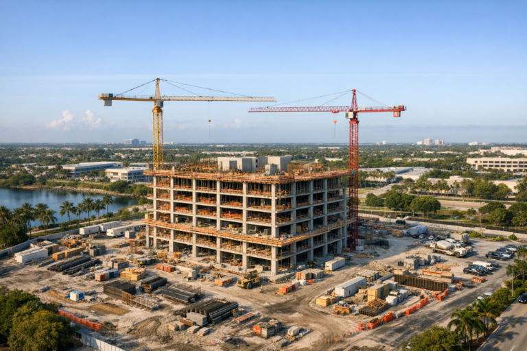
Drones are especially valuable because they can capture consistent aerial perspectives that are difficult or impossible to achieve from the ground. Aerial views can show the relationship between multiple buildings, parking areas, access roads, drainage areas, material staging, and surrounding infrastructure.
For construction progress documentation, a drone can provide a repeatable set of views across the entire project. This might include four corner perspectives, one or two top-down site overviews, detailed angles of key structures, and ground-level or lower-altitude detail shots where appropriate. Over time, this creates a visual timeline that is easy to review and share.
In South Florida, drone documentation can be particularly helpful because many projects involve dense urban sites, coastal properties, active commercial corridors, and space-constrained construction areas. Aerial perspectives can show how a project fits within its surrounding environment while also documenting the work happening inside the site boundaries.
Building a Practical Shot Plan Before the First Visit
The best time to plan for consistency is before the first progress shoot. A clear shot plan helps ensure that each future visit follows the same documentation strategy.
A practical construction photography shot plan may include:
- Primary aerial views from the main site corners
- Top-down images of the full property or active work zones
- Oblique views that show vertical construction progress
- Key access points, entrances, and logistics areas
- Specific areas of interest requested by the owner, contractor, or design team
- Close-up documentation of milestones such as roofing, facade installation, paving, or site work
The shot plan should be detailed enough to guide repeat visits but flexible enough to adapt as the project evolves. As buildings rise, cranes move, or access changes, some angles may need adjustment. The goal is not rigid perfection. The goal is to preserve comparison value while maintaining safe and legal flight operations.
How Consistency Supports Better Communication
Construction projects include many people who may not visit the site regularly. Developers, investors, executives, architects, engineers, leasing teams, marketing teams, and out-of-town owners often rely on photos to understand field progress.
Consistent photo angles help these stakeholders review updates quickly. Instead of asking where a photo was taken or which portion of the site it shows, they can recognize recurring views. This makes progress reports clearer and meetings more efficient.
For general contractors and construction managers, consistent images can also support internal communication. Teams can reference the same visual angles during schedule reviews, coordination meetings, owner updates, and project closeout discussions. The images become a shared reference point.
Documentation Is Different From Marketing Photography
Marketing photography and documentation photography have different goals. Marketing images are often created to be visually dramatic, persuasive, and polished. Documentation images are created to be clear, repeatable, and useful over time.
Both have value. A project may need high-impact drone videography for a development update and consistent progress photos for project records. The key is understanding the purpose of each deliverable. A beautiful angle that changes every month may be excellent for social media but limited for long-term comparison. A repeated angle may be less dramatic, yet far more valuable for decision-making.
The strongest construction media plan often includes both: a core set of repeatable documentation angles plus selected creative images for presentations, public relations, leasing, or stakeholder communications.
Safety and Compliance Should Guide Every Flight
Consistency should never come at the expense of safety or regulatory compliance. Commercial drone operations must be conducted by a properly certified remote pilot under applicable FAA rules. Site conditions, airspace, nearby people, cranes, temporary structures, weather, and operational hazards all affect how a flight should be planned.
A professional drone provider should know how to balance the desire for repeatable imagery with safe decision-making. Sometimes an ideal angle may not be possible on a particular day because of site activity, equipment placement, wind, restricted access, or airspace considerations. In those cases, the operator should choose the safest suitable alternative while preserving as much documentation continuity as possible.
Best Practices for Long-Term Construction Progress Documentation
To get the most value from recurring progress photography, project teams should treat visual documentation as part of the project workflow rather than an afterthought.
- Start early so the record includes pre-construction or site preparation conditions.
- Use a consistent schedule, such as weekly, biweekly, or monthly documentation.
- Define the most important site areas before the first flight.
- Keep a core set of repeatable views for every visit.
- Add supplemental images when major milestones or conditions change.
- Organize files by date and project phase for easier retrieval.
- Communicate upcoming priorities before each shoot when special documentation is needed.
These practices help turn individual photo sessions into a structured archive. The more organized the process, the more useful the images become for reporting, team alignment, and historical reference.
What to Look for in a Drone Partner
When hiring a drone company for construction progress documentation, look beyond image quality alone. Sharp, well-composed photos are important, but construction documentation requires reliability, process, and an understanding of what project teams need.
A qualified drone partner should be able to discuss repeatable shot planning, safe flight operations, FAA Part 107 commercial certification, scheduling consistency, file organization, and how the imagery will be used by stakeholders. The provider should also understand that construction sites are active work environments, not photo backdrops. Professionalism, communication, and safety awareness matter.
For projects in South Florida, local experience is also valuable. Weather patterns, coastal light, urban airspace considerations, and dense commercial areas can all influence drone planning. A local provider that understands these conditions can help create a smoother documentation process.
FAQ
How often should construction progress photos be taken?
The right schedule depends on the project size, pace, and reporting needs. Many commercial projects benefit from weekly, biweekly, or monthly documentation. Fast-moving phases may require more frequent updates, while slower phases may need less frequent coverage.
Do all photos need to be taken from the exact same position?
Exact duplication is helpful but not always realistic on an active construction site. The priority is to maintain consistent viewpoints, framing, altitude, and orientation as closely as safety and site conditions allow.
Are drone photos better than ground photos for progress documentation?
Drone photos and ground photos serve different purposes. Drone images are excellent for overall site context, layout, and large-scale comparison. Ground photos are useful for close-up details and interior or trade-specific documentation. Many projects benefit from both.
Can consistent aerial photos help with stakeholder reporting?
Yes. Repeated aerial views make it easier for owners, investors, executives, and remote team members to understand progress without needing to visit the site. They create a clear visual timeline that supports written reports and meetings.
When should a project begin drone documentation?
Ideally, documentation should begin before major work starts. Pre-construction imagery can capture existing conditions, site clearing, access points, and surrounding context, creating a stronger record from the very beginning.
Conclusion
Consistent photo angles are one of the simplest ways to make construction progress documentation more useful. They create visual continuity, reduce confusion, support better communication, and help project teams understand change over time. Without consistency, even high-quality images can lose much of their long-term value.
For owners, developers, contractors, and construction managers, a thoughtful drone documentation plan can provide a reliable visual record from pre-construction through completion. The key is working with a professional team that understands repeatable shot planning, construction site realities, and safe commercial drone operations.
Skyview Motions provides commercial drone photography and videography for construction projects throughout South Florida, with an emphasis on clear, consistent, and practical visual documentation. If your project needs dependable progress imagery that supports real decision-making, a structured drone documentation plan is a strong place to start.