A home can look beautiful from the ground, but ground-level photos rarely explain why the location matters. Buyers, investors, tenants, and decision-makers want to understand more than finishes, square footage, and curb appeal. They want to see how the property sits within its surroundings, how accessible it is, what is nearby, and what makes the location valuable.
That is where real estate drone photography becomes especially useful. Aerial images can show the full story of a property in a way traditional photography cannot. Instead of presenting a building as an isolated structure, drone photography shows the relationship between the property, the neighborhood, nearby roads, water, green space, commercial corridors, schools, retail areas, parking, and other location-based features that influence perception and value.
For real estate professionals, developers, property managers, and marketers, this context can make the difference between a listing that looks attractive and one that feels easy to understand. When buyers can visually connect the property to its surroundings, they can evaluate the opportunity faster and with more confidence.
Why Location Is Often Hard to Communicate With Ground Photography
Traditional real estate photography is excellent for interiors, exterior details, finishes, landscaping, and street-level presentation. It is an essential part of any listing. But it has limits. A camera at ground level can only show what is directly in front of the lens.
That means important location details are often left out or only mentioned in the listing description. A property may be minutes from a major roadway, close to a waterfront area, adjacent to new development, or positioned near retail and restaurants, but buyers may not fully understand that value until they see it.
Written descriptions can help, but they require the viewer to imagine the setting. Drone photography removes much of that guesswork. A well-planned aerial image shows the physical layout clearly, helping viewers understand what is nearby and how the property fits into the larger area.
What Real Estate Drone Photography Reveals That Ground Photos Cannot
Effective aerial photography is not simply about taking a high-altitude picture. The goal is to capture meaningful context from the right angle, height, and composition. For real estate marketing, the most useful drone images reveal information that supports a buyer or investor decision.
Neighborhood Context
Aerial images show the character of the surrounding neighborhood. Viewers can see whether the property is located in a dense urban setting, a quiet residential area, a coastal community, a commercial district, or a mixed-use corridor. This helps set expectations before someone schedules a showing or requests more information.
For residential properties, neighborhood context can communicate privacy, lot placement, nearby homes, parks, canals, golf courses, or community amenities. For commercial properties, it can show adjacent businesses, traffic corridors, corner positioning, and nearby development patterns.
Access and Visibility
Access is a major factor in both residential and commercial real estate. Drone photography can show proximity to main roads, intersections, parking areas, entrances, driveways, and surrounding transportation routes. This is especially important for retail properties, office buildings, industrial sites, multifamily communities, hospitality properties, and development parcels.
For commercial real estate, aerial images can make visibility easier to understand. A building located along a heavily traveled road, near an intersection, or within a recognizable business area may have location advantages that are difficult to capture from the sidewalk.
Water, Green Space, and Natural Features
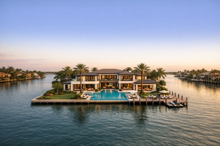
In South Florida, location often includes lifestyle and environmental features such as canals, marinas, beaches, lakes, golf courses, preserves, and landscaped communities. These features can be major selling points, but they are often invisible from standard exterior photos.
Aerial photography can capture the relationship between the property and these nearby features. A home near water, a commercial property close to a marina, or a development site near open land can be presented in a way that immediately communicates location-based appeal.
Lot Size, Layout, and Property Boundaries
While drone photography should not replace a professional survey, it can visually communicate how a parcel is arranged. Buyers can better understand lot shape, building placement, outdoor areas, parking fields, loading zones, landscaping, and nearby structures.
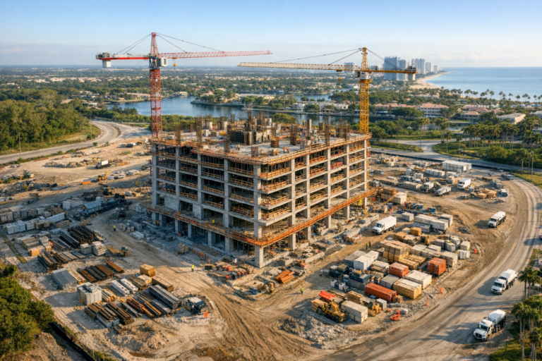
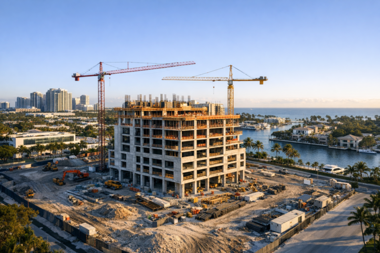
This is especially valuable for larger residential estates, commercial parcels, industrial properties, construction sites, and land listings. Aerial imagery gives viewers a clearer sense of scale than ground photos alone.
How Aerial Images Help Buyers Make Faster Decisions
Most buyers begin their search online. They are comparing multiple properties quickly, often across different neighborhoods or markets. When a listing includes strong aerial visuals, it answers location questions early in the decision process.
Instead of wondering how close a property is to nearby amenities or whether the surrounding area matches their needs, viewers can see the context quickly. This can reduce uncertainty and help serious prospects decide whether the property is worth further consideration.
For agents and property marketers, this can improve the quality of inquiries. Aerial imagery may help filter out prospects who are not a good fit while giving qualified buyers the confidence to take the next step.
Why Drone Photography Is Especially Valuable in South Florida
South Florida real estate is highly location-driven. Waterfront access, coastal proximity, neighborhood identity, traffic patterns, gated communities, urban corridors, and nearby amenities can all influence how a property is perceived.
Aerial photography is particularly useful in this market because many location advantages are spatial. A property may be close to the Intracoastal, near a major highway, positioned within a growing commercial district, or surrounded by lifestyle amenities. These details are easier to understand visually than through description alone.
Weather, light, and seasonality also matter. Professional drone photographers plan around lighting conditions, wind, airspace requirements, and the visual goals of the shoot. In South Florida, early morning and late afternoon often provide softer light, better shadows, and more polished imagery for real estate marketing.
Common Real Estate Uses for Drone Photography
Real estate drone photography is useful across many property types, not just luxury homes. The strongest applications are those where location, scale, access, or surroundings influence value.
- Residential listings: Show neighborhood layout, nearby water, lot size, outdoor living areas, and community setting.
- Commercial real estate: Highlight road frontage, signage visibility, parking, access points, surrounding businesses, and nearby demand drivers.
- Multifamily properties: Show building placement, amenities, surrounding roads, parking, green space, and neighborhood proximity.
- Development sites: Communicate parcel context, adjacent land uses, nearby infrastructure, and surrounding growth.
- Hospitality properties: Show proximity to beaches, entertainment districts, marinas, shopping areas, or destination amenities.
- Industrial properties: Highlight loading areas, large lots, truck access, nearby highways, and operational layout.
What Makes a Strong Real Estate Drone Photo
Not every aerial image adds value. A drone photo should be intentional, composed, and useful. Height alone does not make an image effective. In fact, flying too high may make the property feel small or disconnected from the scene.
Strong real estate drone photography usually includes several qualities:
- Clear subject placement: The property should be easy to identify and visually centered when appropriate.
- Useful context: Surroundings should help explain the property, not distract from it.
- Balanced composition: Roads, water, landscaping, and buildings should be framed in a way that feels polished and intentional.
- Natural lighting: The time of day should support clean lines, attractive shadows, and accurate color.
- Proper altitude and angle: The image should show enough context without losing architectural detail.
- Professional editing: Final images should look natural, clean, and consistent with the rest of the marketing package.
Planning a Drone Shoot for Better Location Storytelling
The best results come from preparation. Before the drone ever leaves the ground, the photographer should understand what the property needs to communicate. Is the main value waterfront proximity? Road visibility? Privacy? Scale? Nearby development? Community amenities?
A short planning conversation can help determine the most important angles and priorities. For example, a commercial property may need images that show traffic access and nearby retail anchors, while a waterfront residence may need lower oblique angles that show both the home and the water relationship.
Timing is another important consideration. Harsh midday light can create strong contrast and reduce visual appeal, while late afternoon light may add warmth and dimension. Weather, wind, airspace, and surrounding activity should also be considered. A professional drone operator will evaluate these factors while following applicable FAA requirements and safe operating practices.
Drone Photography and Trust in Real Estate Marketing
Accurate visual communication builds trust. Buyers do not want to feel surprised by the property surroundings after they arrive. Aerial images help create a clearer expectation before a showing, tour, or investment discussion.
For real estate professionals, this transparency can strengthen the marketing package. It shows that the listing is being presented carefully and that the location story is being communicated visually, not hidden or minimized. This is especially important for higher-value listings, commercial properties, and projects where decision-makers may be reviewing opportunities remotely.
Choosing the Right Drone Photography Partner
Hiring a drone provider for real estate is not only about getting attractive images. It is about working with someone who understands property marketing, airspace awareness, visual storytelling, composition, safety, and the practical needs of business clients.
Look for a provider that is FAA Part 107 certified, carries a professional approach to safety, understands how to plan around site conditions, and can explain how the shoot will support your marketing goals. For commercial real estate, construction, events, and property marketing, experience with business-focused deliverables is especially important.
Skyview Motions provides commercial drone photography and videography services throughout South Florida, helping real estate professionals and business clients capture not only the property, but the context that makes the property meaningful.
FAQ
Is drone photography worth it for real estate listings?
Drone photography is often worth it when the property’s location, surroundings, lot size, access, or nearby amenities affect its value. It is especially helpful for waterfront homes, commercial properties, larger lots, development sites, multifamily communities, and listings where location context matters.
How many drone photos does a real estate listing need?
The right number depends on the property and marketing plan. Many listings benefit from a focused set of aerial images showing the front, rear, top-down view, surrounding area, access points, and key location features. Quality and relevance matter more than volume.
Can drone photography show property lines?
Drone photos can help viewers understand the general layout of a property, but they should not be treated as a substitute for a professional survey. If property boundaries need to be shown, they should be handled carefully and based on accurate source information.
Do drone operators need certification for real estate work?
In the United States, drone flights conducted for commercial purposes, including real estate marketing, generally require the operator to hold an FAA Part 107 remote pilot certificate and comply with applicable FAA rules.
What is the best time of day for real estate drone photography?
Early morning and late afternoon often provide attractive natural light, softer shadows, and better overall visual quality. The best time depends on the property’s orientation, weather, surroundings, and the specific images needed.
Conclusion
Strong real estate marketing does more than show rooms, finishes, and exterior details. It helps people understand place. Real estate drone photography gives buyers and decision-makers a clearer view of location, access, surroundings, and value in a way ground-level images cannot fully deliver.
For properties where context matters, aerial imagery can make the listing easier to understand, more informative, and more compelling. If you are marketing a property in South Florida and want visuals that show the full story, Skyview Motions can help capture professional drone photography designed for clarity, trust, and effective real estate presentation.